
IMAGES TAKEN NEAR TO
Mill Lane, PERSHORE, WR10 2AF
Introduction
This page details the photographs taken nearby to Mill Lane, WR10 2AF by members of the Geograph project.
The Geograph project started in 2005 with the aim of publishing, organising and preserving representative images for every square kilometre of Great Britain, Ireland and the Isle of Man.

There are currently over 7.5m images from over14,400 individuals and you can help contribute to the project by visiting https://www.geograph.org.uk
Image Map
Images are licensed for reuse under creativecommons.org/licenses/by-sa/2.0
Notes
- Clicking on the map will re-center to the selected point.
- The higher the marker number, the further away the image location is from the centre of the postcode.
Image Listing (10 Images Found)
Images are licensed for reuse under creativecommons.org/licenses/by-sa/2.0
Image
Details
Distance
1

Caldwell Mill
https://historicengland.org.uk/listing/the-list/list-entry/1116751?section=official-list-entry
Image: © Sandy Gerrard
Taken: 2 May 2024
0.15 miles
2

Caldewell Mill
Photographed from the public road. It looks nothing like a picture I have in a book and has been converted to a dwelling. The wheel does survive round the back in a somewhat enclosed space.
Image: © Chris Allen
Taken: 21 Feb 2010
0.16 miles
3

Caldwell Mill viewed across a ploughed field
Caldwell Mill is situated on the edge of woodland. The former mill has been converted into residential accommodation.
Image: © Philip Halling
Taken: 18 Feb 2007
0.17 miles
4

Bridge near Caldewell Mill
Bridge over a stream near Caldewell Mill on the Wadborough to Brakes Broughton road.
Image: © Philip Halling
Taken: 18 Feb 2007
0.19 miles
5
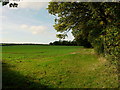
Footpath by Mill Rough
Named woodland to the right.
Nice wide headland, thank you farmer!
Image: © Jonathan Billinger
Taken: 24 Oct 2013
0.19 miles
6
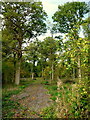
Mill Rough viewed from Chevington Lane
Some nice mature hardwoods here and a crab apple to the right.
Image: © Jonathan Billinger
Taken: 24 Oct 2013
0.19 miles
7
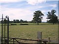
Caldewell
Caldewell House and parkland from the Pershore - Worcester road, looking south-west towards the Malverns.
Image: © Dave Bushell
Taken: 7 Sep 2005
0.21 miles
8

Mistletoe Farm
A whole line of trees infected with mistletoe on the edge of Deerfold Wood.
Image: © Jeff Gogarty
Taken: 10 May 2018
0.21 miles

