1
Your local supermarket in Pershore
Costcutter store at 2 Hurst Road, near the A4104 Station Road junction.
Image: © Jaggery
Taken: 16 Nov 2014
0.02 miles
2
Hurst Road, Pershore
On the east side of the A4104 Station Road in the north of Pershore.
Image: © Jaggery
Taken: 16 Nov 2014
0.02 miles
3
Row of bungalows, Pershore
Located between Station Road and Hurst Road. Originally, bungalow was used in English for a lightly-built house, with a veranda and one storey. In current UK usage it is a convenient word for any one-storey dwelling.
Image: © Jaggery
Taken: 16 Nov 2014
0.03 miles
4
Bus shelter, Station Road, Pershore
The bus stop serves the estates to the east of Station Road. To the left of the shelter is the service road running parallel to Station Road.
Image: © David Smith
Taken: 8 Oct 2016
0.05 miles
5
Pershore Care Centre
Worcestershire County Council's Pershore Short Term Breaks Service care home at 48 Station Road.
Image: © Jaggery
Taken: 16 Nov 2014
0.05 miles
6
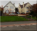
Steps to Station Road houses, Pershore
Viewed from the corner of Hurst Road. The houses are set back from, and a little above, the road.
Image: © Jaggery
Taken: 16 Nov 2014
0.05 miles
7
Corner of Station Road and Mayfield Road, Pershore
Pointing right,the blue cycle route and footpath sign shows three-quarters of a mile to the town centre.
Image: © Jaggery
Taken: 16 Nov 2014
0.06 miles
8
Gas installation, Station Road, Pershore
Wales & West Utilities gas installation.
Image: © Jaggery
Taken: 16 Nov 2014
0.07 miles
9
Furlongs Road, Pershore
Viewed across Hurst Road. A Costcutter store http://www.geograph.org.uk/photo/4247656 is behind the camera.
Image: © Jaggery
Taken: 16 Nov 2014
0.08 miles
10
Hurst Road, Pershore
In the 1960s housing was built beside the Station Road to the north of Pershore's town centre.
Image: © Philip Halling
Taken: 23 Nov 2008
0.08 miles


