IMAGES TAKEN NEAR TO
Spencer Mews, SKELMERSDALE, WN8 9LA
Introduction
This page details the photographs taken nearby to Spencer Mews, WN8 9LA by members of the Geograph project.
The Geograph project started in 2005 with the aim of publishing, organising and preserving representative images for every square kilometre of Great Britain, Ireland and the Isle of Man.

There are currently over 7.5m images from over14,400 individuals and you can help contribute to the project by visiting https://www.geograph.org.uk
Image Map
Images are licensed for reuse under creativecommons.org/licenses/by-sa/2.0
Notes
- Clicking on the map will re-center to the selected point.
- The higher the marker number, the further away the image location is from the centre of the postcode.
Image Listing (10 Images Found)
Images are licensed for reuse under creativecommons.org/licenses/by-sa/2.0
Image
Details
Distance
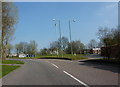
1
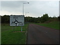
Approaching Thorn Island
Heading west on Gillbrands Road.
Image: © JThomas
Taken: 13 Sep 2014
0.05 miles
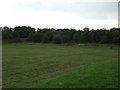
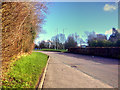
3
Approaching roundabout on Whiteledge Road
Image: © Alexander P Kapp
Taken: 28 Mar 2011
0.11 miles
4
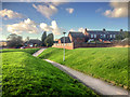
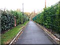
Path at Digmoor
Path leading to Daniels Lane.
Image: © David Dixon
Taken: 10 Feb 2016
0.12 miles
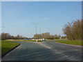
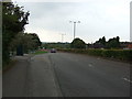
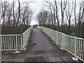
5
Footbridge over Whitelodge Road
Heading south.
Image: © JThomas
Taken: 13 Sep 2014
0.14 miles
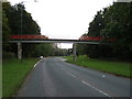
10
Footbridge over Whiteledge Road, East Gillibrands
Image: © Gary Rogers
Taken: 22 Feb 2016
0.24 miles