IMAGES TAKEN NEAR TO
Blaguegate Lane, SKELMERSDALE, WN8 8TY
Introduction
This page details the photographs taken nearby to Blaguegate Lane, WN8 8TY by members of the Geograph project.
The Geograph project started in 2005 with the aim of publishing, organising and preserving representative images for every square kilometre of Great Britain, Ireland and the Isle of Man.

There are currently over 7.5m images from over14,400 individuals and you can help contribute to the project by visiting https://www.geograph.org.uk
Image Map
Images are licensed for reuse under creativecommons.org/licenses/by-sa/2.0
Notes
- Clicking on the map will re-center to the selected point.
- The higher the marker number, the further away the image location is from the centre of the postcode.
Image Listing (6 Images Found)
Images are licensed for reuse under creativecommons.org/licenses/by-sa/2.0
Image
Details
Distance
2
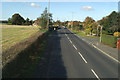
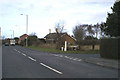
Bus Stop at the junction of Firswood Road with Blaguegate Lane (A577)
As seen from the top deck of the 375 Wigan - Southport bus.
Image: © David Long
Taken: 16 Oct 2009
0.14 miles
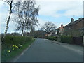
3
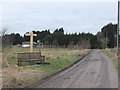
Bench at junction of Holland's Lane and Halfpenny Lane, Blaguegate
Image: © Gary Rogers
Taken: 25 Feb 2016
0.17 miles
4
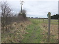
Escape to the country
Firswood Road leads off the Wigan - Ormskirk A577
Image: © David Long
Taken: 17 Feb 2006
0.20 miles