IMAGES TAKEN NEAR TO
Chorley Road, WIGAN, WN8 7AN
Introduction
This page details the photographs taken nearby to Chorley Road, WN8 7AN by members of the Geograph project.
The Geograph project started in 2005 with the aim of publishing, organising and preserving representative images for every square kilometre of Great Britain, Ireland and the Isle of Man.

There are currently over 7.5m images from over14,400 individuals and you can help contribute to the project by visiting https://www.geograph.org.uk
Image Map
Images are licensed for reuse under creativecommons.org/licenses/by-sa/2.0
Notes
- Clicking on the map will re-center to the selected point.
- The higher the marker number, the further away the image location is from the centre of the postcode.
Image Listing (9 Images Found)
Images are licensed for reuse under creativecommons.org/licenses/by-sa/2.0
Image
Details
Distance
4
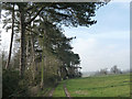
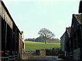
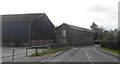
Farmtrack at edge of Damney Wood, Parbold
Image: © Gary Rogers
Taken: 15 Feb 2015
0.10 miles
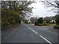
6
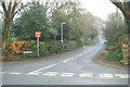
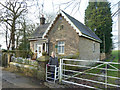
To the high road
A narrow lane leading to High Moor.
Image: © David Long
Taken: 4 Jan 2006
0.20 miles
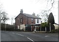
8
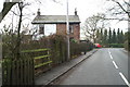
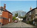
Different strokes
The different tastes of folk who live next door to each other are obvious.
Image: © David Long
Taken: 4 Jan 2006
0.24 miles