IMAGES TAKEN NEAR TO
Wilkinson Street, LEIGH, WN7 4DQ
Introduction
This page details the photographs taken nearby to Wilkinson Street, WN7 4DQ by members of the Geograph project.
The Geograph project started in 2005 with the aim of publishing, organising and preserving representative images for every square kilometre of Great Britain, Ireland and the Isle of Man.

There are currently over 7.5m images from over14,400 individuals and you can help contribute to the project by visiting https://www.geograph.org.uk
Image Map (Loading...)


Getting Data...Please wait
Leaflet Map data © OpenStreetMap
Images are licensed for reuse under creativecommons.org/licenses/by-sa/2.0
Notes
- Clicking on the map will re-center to the selected point.
- The higher the marker number, the further away the image location is from the centre of the postcode.
Image Listing (110 Images Found)
Images are licensed for reuse under creativecommons.org/licenses/by-sa/2.0
Image
Details
Distance
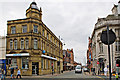
1
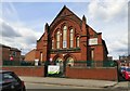
Former church on Cook Street
The former Primitive Methodist Church is now used by a Day Nursery.
Image: © Gerald England
Taken: 28 Apr 2018
0.07 miles
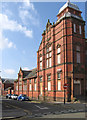
3

Leigh Town Hall
1907. Architect J C Prestwich.
Image: © S Parish
Taken: 21 Jan 2006
0.08 miles
4
Leigh - Pentecostal Church
On Ullswater Street.
Image: © Dave Bevis
Taken: 9 Sep 2014
0.08 miles
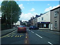
5
Twist Lane
The A578 at the corner of Cook Street.
Image: © Gerald England
Taken: 28 Apr 2018
0.09 miles
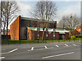
6
Leigh - former college on Ullswater Street
Image: © Dave Bevis
Taken: 9 Sep 2014
0.10 miles
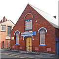
7
Kingsleigh Methodist Church
The Kingsleigh Methodist Church, on King's Road, Leigh.
Image: © David Dixon
Taken: 24 Mar 2011
0.10 miles
8
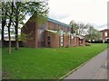
Kingsleigh Methodist Church
On Kings Road, Leigh.
Image: © Gerald England
Taken: 28 Apr 2018
0.10 miles
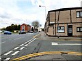
10
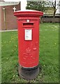
GR Postbox (WN7 33)
On King Street, Leigh.
Image: © Gerald England
Taken: 28 Apr 2018
0.11 miles