IMAGES TAKEN NEAR TO
Penfield Road, LEIGH, WN7 3PF
Introduction
This page details the photographs taken nearby to Penfield Road, WN7 3PF by members of the Geograph project.
The Geograph project started in 2005 with the aim of publishing, organising and preserving representative images for every square kilometre of Great Britain, Ireland and the Isle of Man.

There are currently over 7.5m images from over14,400 individuals and you can help contribute to the project by visiting https://www.geograph.org.uk
Image Map
Images are licensed for reuse under creativecommons.org/licenses/by-sa/2.0
Notes
- Clicking on the map will re-center to the selected point.
- The higher the marker number, the further away the image location is from the centre of the postcode.
Image Listing (12 Images Found)
Images are licensed for reuse under creativecommons.org/licenses/by-sa/2.0
Image
Details
Distance

7
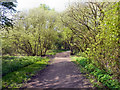
Pennington Flash Country Park
Part of the park between the Flash and St Helens Road. Originally filled in with domestic waste in the early twentieth century to prevent flooding, the area has been planted with trees which are now beginning to mature.
Image: © David Dixon
Taken: 19 Apr 2011
0.23 miles
8
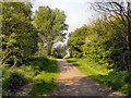
Pennington Flash Country Park
Part of the park between the Flash and St Helens Road. Originally filled in with domestic waste in the early twentieth century to prevent flooding, the area has been planted with trees which are now beginning to mature.
Image: © David Dixon
Taken: 19 Apr 2011
0.23 miles
9

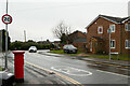
Old Boundary Marker by the A572, St Helens Road, Golborne Parish
Parish Boundary Marker by the A572, in parish of Golborne (Wigan District), No. 462 St Helens Road, 100m East of Shepherds Inn, against garden wall of house with road name plate, North side of road.
Inscription reads:-
: LOWTON : : BOUNDARY : : LEIGH :
Surveyed
Milestone Society National ID: LA_BOSH10pb
Image: © Philip Platt
Taken: Unknown
0.23 miles