IMAGES TAKEN NEAR TO
Beacon View, WIGAN, WN6 9AJ
Introduction
This page details the photographs taken nearby to Beacon View, WN6 9AJ by members of the Geograph project.
The Geograph project started in 2005 with the aim of publishing, organising and preserving representative images for every square kilometre of Great Britain, Ireland and the Isle of Man.

There are currently over 7.5m images from over14,400 individuals and you can help contribute to the project by visiting https://www.geograph.org.uk
Image Map
Images are licensed for reuse under creativecommons.org/licenses/by-sa/2.0
Notes
- Clicking on the map will re-center to the selected point.
- The higher the marker number, the further away the image location is from the centre of the postcode.
Image Listing (10 Images Found)
Images are licensed for reuse under creativecommons.org/licenses/by-sa/2.0
Image
Details
Distance
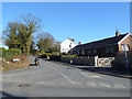
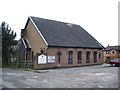
1
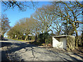
Skull House Lane about to join Appley Lane North
Image: © Peter Bond
Taken: 25 Apr 2015
0.06 miles
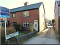
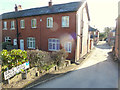
6
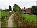
Path between Worthington's Farm and Draper's Farm House
Image: © Gary Rogers
Taken: 15 Dec 2019
0.14 miles
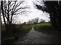
8
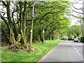
Appley Lane North
The B5375 north of Appley Bridge. The western side (right) is residential and there is a well established strip of woodland to the east.
Image: © Richard Webb
Taken: 23 Apr 2011
0.21 miles