IMAGES TAKEN NEAR TO
Spruce Road, WIGAN, WN6 8PQ
Introduction
This page details the photographs taken nearby to Spruce Road, WN6 8PQ by members of the Geograph project.
The Geograph project started in 2005 with the aim of publishing, organising and preserving representative images for every square kilometre of Great Britain, Ireland and the Isle of Man.

There are currently over 7.5m images from over14,400 individuals and you can help contribute to the project by visiting https://www.geograph.org.uk
Image Map
Images are licensed for reuse under creativecommons.org/licenses/by-sa/2.0
Notes
- Clicking on the map will re-center to the selected point.
- The higher the marker number, the further away the image location is from the centre of the postcode.
Image Listing (9 Images Found)
Images are licensed for reuse under creativecommons.org/licenses/by-sa/2.0
Image
Details
Distance
1
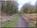
Path following Dismantled Railway Line near Giants Hall, Standish Lower Ground
Image: © Gary Rogers
Taken: 4 Mar 2017
0.12 miles
2
Footpath near Giants Hall, Standish Lower Ground
Image: © Gary Rogers
Taken: 4 Mar 2017
0.17 miles
3
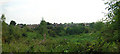
Beech Hill
The gigantic Beech Hill council housing estate forms the skyline viewed across the valley from Giants Hall farm
Image: © David Hignett
Taken: 4 Sep 2005
0.21 miles
4
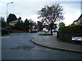
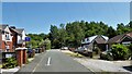
Beech Hill Avenue/Beech Hill Lane junction
Image: © Colin Pyle
Taken: 26 Sep 2012
0.21 miles
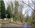
5
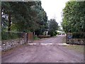
Giant's Hall Road
A bridleway at the top of this residential cul-de-sac leads past Giant's Hall on a route towards Gidlow
Image: © Kevin Waterhouse
Taken: 5 Jun 2023
0.23 miles
6
Footpaths near Giant's Hall, Standish Lower Ground
Image: © Gary Rogers
Taken: 4 Mar 2017
0.24 miles
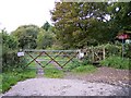
7
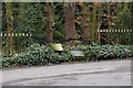
Entrance to Giants Hall Farm
This imposing old plough identifies the entrance to Giants Hall farm.
Image: © Edward Marshall
Taken: 21 Mar 2010
0.24 miles
9
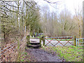
Entrance to Bridleway for Standish Lower Ground
Image: © Raymond Knapman
Taken: 24 Sep 2010
0.25 miles