IMAGES TAKEN NEAR TO
Old Pepper Lane, WIGAN, WN6 0PH
Introduction
This page details the photographs taken nearby to Old Pepper Lane, WN6 0PH by members of the Geograph project.
The Geograph project started in 2005 with the aim of publishing, organising and preserving representative images for every square kilometre of Great Britain, Ireland and the Isle of Man.

There are currently over 7.5m images from over14,400 individuals and you can help contribute to the project by visiting https://www.geograph.org.uk
Image Map
Images are licensed for reuse under creativecommons.org/licenses/by-sa/2.0
Notes
- Clicking on the map will re-center to the selected point.
- The higher the marker number, the further away the image location is from the centre of the postcode.
Image Listing (18 Images Found)
Images are licensed for reuse under creativecommons.org/licenses/by-sa/2.0
Image
Details
Distance
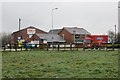
1
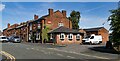
Foresters Arms
Foresters Arms public house.
Image: © Peter McDermott
Taken: 7 Jul 2023
0.11 miles
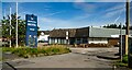
2
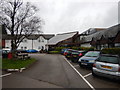
Shevington Moor - Britannia Hotel Entrance
Wikipedia : https://en.wikipedia.org/wiki/Britannia_Hotels
Image: © James Emmans
Taken: 16 Apr 2017
0.16 miles
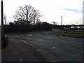
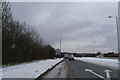
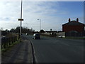
6
Almond Brook Road
Link between Standish and the M6.
Image: © Richard Webb
Taken: 3 Apr 2015
0.19 miles
9
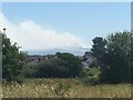
Winter Hill seen from Shevington Moor
A pair of moorland fires are about to merge. Much of the moorland on Winter Hill was on fire and the smoke extended to the coast.
Image: © Richard Webb
Taken: 30 Jun 2018
0.21 miles