IMAGES TAKEN NEAR TO
Calderbank Street, WIGAN, WN5 9JF
Introduction
This page details the photographs taken nearby to Calderbank Street, WN5 9JF by members of the Geograph project.
The Geograph project started in 2005 with the aim of publishing, organising and preserving representative images for every square kilometre of Great Britain, Ireland and the Isle of Man.

There are currently over 7.5m images from over14,400 individuals and you can help contribute to the project by visiting https://www.geograph.org.uk
Image Map
Images are licensed for reuse under creativecommons.org/licenses/by-sa/2.0
Notes
- Clicking on the map will re-center to the selected point.
- The higher the marker number, the further away the image location is from the centre of the postcode.
Image Listing (11 Images Found)
Images are licensed for reuse under creativecommons.org/licenses/by-sa/2.0
Image
Details
Distance
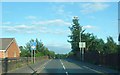

6
Between Ellesmere Road and Ormskirk Road, Pemberton
Image: © Gary Rogers
Taken: 22 Nov 2016
0.21 miles
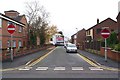
7
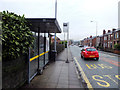
Bus stop on A571 Billinge Road, Newtown
Image: © Gary Rogers
Taken: 10 Dec 2016
0.21 miles
8
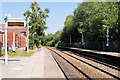
Pemberton Railway Station (view west)
Looking west, towards Wigan.
The station was opened on 20 November 1848 by the Liverpool and Bury Railway it now serves the Kirkby branch line from Wigan Wallgate. There are basic passenger shelters on both platforms.
Image: © David Dixon
Taken: 23 Jul 2019
0.23 miles