IMAGES TAKEN NEAR TO
Ashfield Crescent, WIGAN, WN5 7TE
Introduction
This page details the photographs taken nearby to Ashfield Crescent, WN5 7TE by members of the Geograph project.
The Geograph project started in 2005 with the aim of publishing, organising and preserving representative images for every square kilometre of Great Britain, Ireland and the Isle of Man.

There are currently over 7.5m images from over14,400 individuals and you can help contribute to the project by visiting https://www.geograph.org.uk
Image Map
Images are licensed for reuse under creativecommons.org/licenses/by-sa/2.0
Notes
- Clicking on the map will re-center to the selected point.
- The higher the marker number, the further away the image location is from the centre of the postcode.
Image Listing (57 Images Found)
Images are licensed for reuse under creativecommons.org/licenses/by-sa/2.0
Image
Details
Distance


5
Expressions of Beauty, Main Street, Billinge
Image: © Gary Rogers
Taken: 8 Jan 2016
0.10 miles
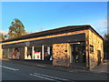
7
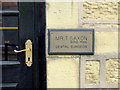
Mr T. Saxon, Dental Surgeon
Main Street, Billinge.
Image: © Gary Rogers
Taken: 7 May 2014
0.10 miles
10

Joint Churches' Annual Parade, Billinge. 2014
Image: © Gary Rogers
Taken: 29 Jun 2014
0.11 miles