IMAGES TAKEN NEAR TO
Gathurst Road, WIGAN, WN5 0LJ
Introduction
This page details the photographs taken nearby to Gathurst Road, WN5 0LJ by members of the Geograph project.
The Geograph project started in 2005 with the aim of publishing, organising and preserving representative images for every square kilometre of Great Britain, Ireland and the Isle of Man.

There are currently over 7.5m images from over14,400 individuals and you can help contribute to the project by visiting https://www.geograph.org.uk
Image Map
Images are licensed for reuse under creativecommons.org/licenses/by-sa/2.0
Notes
- Clicking on the map will re-center to the selected point.
- The higher the marker number, the further away the image location is from the centre of the postcode.
Image Listing (11 Images Found)
Images are licensed for reuse under creativecommons.org/licenses/by-sa/2.0
Image
Details
Distance
1
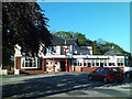
The Vale Royal - for a cheap and cheerful carvery
Image: © Ian Greig
Taken: 24 May 2010
0.11 miles
4
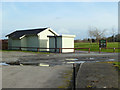
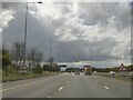
Porters Wood Golf Course, Gathurst Road
Image: © Gary Rogers
Taken: 24 Feb 2015
0.17 miles
7
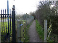
Footpath from Gathurst Road to Spring Road, Orrell
Image: © Gary Rogers
Taken: 24 Feb 2015
0.19 miles
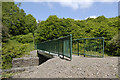
8
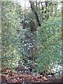
Gathurst Wood
A deep wooded reentrant off Gathurst Road.
Image: © Richard Webb
Taken: 27 Dec 2009
0.20 miles
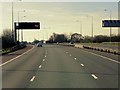
9
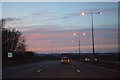
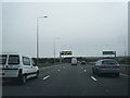
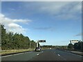
Metropolitan Borough of Wigan : The M6 Motorway
Heading north through the Borough of Wigan on the M6 Motorway.
Image: © Lewis Clarke
Taken: 21 Apr 2016
0.22 miles