
IMAGES TAKEN NEAR TO
Rookery Avenue, WIGAN, WN4 9PF
Introduction
This page details the photographs taken nearby to Rookery Avenue, WN4 9PF by members of the Geograph project.
The Geograph project started in 2005 with the aim of publishing, organising and preserving representative images for every square kilometre of Great Britain, Ireland and the Isle of Man.

There are currently over 7.5m images from over14,400 individuals and you can help contribute to the project by visiting https://www.geograph.org.uk
Image Map
Images are licensed for reuse under creativecommons.org/licenses/by-sa/2.0
Notes
- Clicking on the map will re-center to the selected point.
- The higher the marker number, the further away the image location is from the centre of the postcode.
Image Listing (47 Images Found)
Images are licensed for reuse under creativecommons.org/licenses/by-sa/2.0
Image
Details
Distance
2
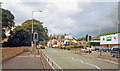
Site of Ashton-in-Makerfield station, on Warrington Road
View northward, towards Ashton and Wigan on the A49, approaching the Bay Horse Inn. The ex-GCR branch from (to right) Lowton and Glazebrook to St Helens (Central) (to left) ran underneath here, until the line closed on 4/1/65: the station had been on the left and closed 3/3/52 when the Glazebrook - St Helens passenger service ceased.
Image: © Ben Brooksbank
Taken: 3 Jul 2002
0.12 miles
3
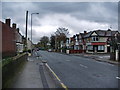
Warrington Road, Ashton-in-Makerfield
Image: © Alexander P Kapp
Taken: 6 Nov 2007
0.17 miles
5
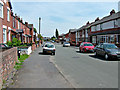
Parish Hall, St Thomas, Ashton-in-Makerfield
Image: © David Long
Taken: 4 Mar 2010
0.17 miles
7
St Thomas Church, Ashton-in-Makerfield, Graveyard
Image: © Alexander P Kapp
Taken: 6 Nov 2007
0.18 miles
8
The Vicarage, St Thomas, Ashton-in-Makerfield
Image: © David Long
Taken: 4 Mar 2010
0.19 miles
9
St Thomas Church, Ashton-in-Makerfield, War Memorial
Image: © Alexander P Kapp
Taken: 6 Nov 2007
0.19 miles
10
St. Oswald & St.Edmund Arrowsmith.
The green (copper) roof of the bell tower is visible from several points around Ashton-in-Makerfield. There are also two copper domes but these are below the level of the surrounding trees and are not visible from a distance.
Image: © Galatas
Taken: 15 Apr 2010
0.19 miles