IMAGES TAKEN NEAR TO
Garswood Old Road, WIGAN, WN4 0XR
Introduction
This page details the photographs taken nearby to Garswood Old Road, WN4 0XR by members of the Geograph project.
The Geograph project started in 2005 with the aim of publishing, organising and preserving representative images for every square kilometre of Great Britain, Ireland and the Isle of Man.

There are currently over 7.5m images from over14,400 individuals and you can help contribute to the project by visiting https://www.geograph.org.uk
Image Map
Images are licensed for reuse under creativecommons.org/licenses/by-sa/2.0
Notes
- Clicking on the map will re-center to the selected point.
- The higher the marker number, the further away the image location is from the centre of the postcode.
Image Listing (10 Images Found)
Images are licensed for reuse under creativecommons.org/licenses/by-sa/2.0
Image
Details
Distance
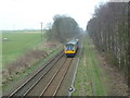
2
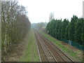
Wigan-St. Helens Railway near Hollin Hay Farm
Image: © David Long
Taken: 2 Dec 2005
0.03 miles
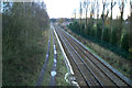
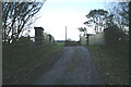
5
Bridge for Hollin Hey Farm
Bridge over St Helens to Wigan railway.Billinge Hill in background.
Image: © Raymond Knapman
Taken: 7 Jul 2008
0.05 miles
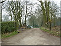
7
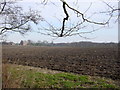
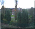
Farmland around Hollin Hay House
Across farmland to Hollin Hay House from the footpath around Carr Mill Dam
Image: © Sue Adair
Taken: 11 Feb 2006
0.07 miles
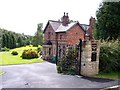
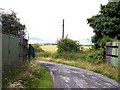
8
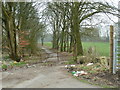
Garswood Old Road south of Hollin Hay House
Image: © Alexander P Kapp
Taken: 14 Mar 2012
0.09 miles