IMAGES TAKEN NEAR TO
Falkland Drive, WIGAN, WN4 0SQ
Introduction
This page details the photographs taken nearby to Falkland Drive, WN4 0SQ by members of the Geograph project.
The Geograph project started in 2005 with the aim of publishing, organising and preserving representative images for every square kilometre of Great Britain, Ireland and the Isle of Man.

There are currently over 7.5m images from over14,400 individuals and you can help contribute to the project by visiting https://www.geograph.org.uk
Image Map
Images are licensed for reuse under creativecommons.org/licenses/by-sa/2.0
Notes
- Clicking on the map will re-center to the selected point.
- The higher the marker number, the further away the image location is from the centre of the postcode.
Image Listing (11 Images Found)
Images are licensed for reuse under creativecommons.org/licenses/by-sa/2.0
Image
Details
Distance
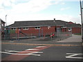
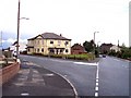
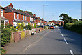
1
Billinge Road nearing Smock Lane junction
Image: © Colin Pyle
Taken: 11 Nov 2017
0.15 miles
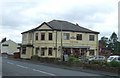
5
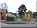
Path between Hamilton Road and Victoria Road, Garswood
Image: © Gary Rogers
Taken: 12 Mar 2017
0.21 miles
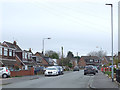
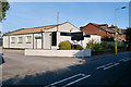
7
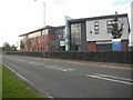
Garswood Primary Care Centre
Doctors' Surgery combined with Pharmacy/Chemist
Image: © Eileen Littler
Taken: 16 Oct 2011
0.21 miles