IMAGES TAKEN NEAR TO
Pinewood Close, WIGAN, WN2 5XS
Introduction
This page details the photographs taken nearby to Pinewood Close, WN2 5XS by members of the Geograph project.
The Geograph project started in 2005 with the aim of publishing, organising and preserving representative images for every square kilometre of Great Britain, Ireland and the Isle of Man.

There are currently over 7.5m images from over14,400 individuals and you can help contribute to the project by visiting https://www.geograph.org.uk
Image Map
Images are licensed for reuse under creativecommons.org/licenses/by-sa/2.0
Notes
- Clicking on the map will re-center to the selected point.
- The higher the marker number, the further away the image location is from the centre of the postcode.
Image Listing (12 Images Found)
Images are licensed for reuse under creativecommons.org/licenses/by-sa/2.0
Image
Details
Distance
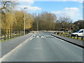
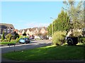
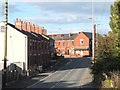
2
Park Lane leading to Ashwood Avenue, Abram
Image: © Gary Rogers
Taken: 2 Oct 2016
0.07 miles
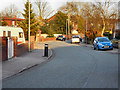
4
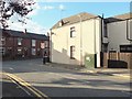
BT Fibre Broadband box at junction of Park Lane and Warrington Road, Abram
Image: © Gary Rogers
Taken: 2 Oct 2016
0.16 miles
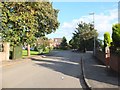
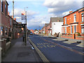
5
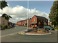
Warrington Road, Abram
Entering the village from the south.
Image: © David Lally
Taken: 27 May 2009
0.17 miles
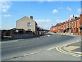
8
Warrington Road, Abram
The A573, Warrington Road, passing through Abram Village.
Image: © David Dixon
Taken: 23 Feb 2012
0.20 miles