
IMAGES TAKEN NEAR TO
Bickershaw Lane, WIGAN, WN2 5TE
Introduction
This page details the photographs taken nearby to Bickershaw Lane, WN2 5TE by members of the Geograph project.
The Geograph project started in 2005 with the aim of publishing, organising and preserving representative images for every square kilometre of Great Britain, Ireland and the Isle of Man.

There are currently over 7.5m images from over14,400 individuals and you can help contribute to the project by visiting https://www.geograph.org.uk
Image Map
Images are licensed for reuse under creativecommons.org/licenses/by-sa/2.0
Notes
- Clicking on the map will re-center to the selected point.
- The higher the marker number, the further away the image location is from the centre of the postcode.
Image Listing (17 Images Found)
Images are licensed for reuse under creativecommons.org/licenses/by-sa/2.0
Image
Details
Distance
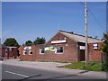
2
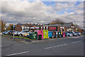
Do your recycling here - Bickershaw Labour Club
Image: © Ian Greig
Taken: 7 Nov 2010
0.03 miles
3
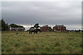
Station Avenue, Bickershaw
The only indication there was a railway hereabouts survives in the name of the short road on which stands these few Council houses. The line crossed about where I was stood, and the station would have been there. Bickershaw Labour Club is on the left.
Image: © David Long
Taken: 10 Oct 2008
0.05 miles
5
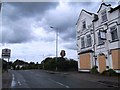
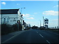
The Queens Public house on the B5237
Public house (currently closed) near the Abram boundary marker
Image: © Anthony Parkes
Taken: 23 Jun 2012
0.09 miles
6
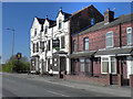
The Queens
Public house (currently closed) on Bickershaw Lane (B5237).
Image: © David Dixon
Taken: 26 Mar 2012
0.09 miles
7
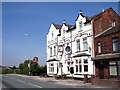
The Queens public house Bickershaw
The ex Great Central Railway branch to Wigan once passed this pub on a level crossing
Image: © Raymond Knapman
Taken: 1 Sep 2010
0.10 miles
8

Bickershaw & Abram Station
View SSE, towards Lowton and Glazebrook; ex-GC Glazebrook - Lowton - Wigan (Central) branch line. Line and station closed 2/11/64.
Image: © Ben Brooksbank
Taken: 16 Apr 1962
0.10 miles
9
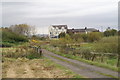
The Queen's Hotel, from down the lane
From the getamap it looks as if the old railway ran across in front of the pub, and that Bickershaw & Abram Station once stood between the pub and myself.
Image: © David Long
Taken: 10 Oct 2008
0.10 miles
10
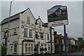
New sign for Bickershaw village
Another settlement within the Abram Ward has recently received its new boundary sign. This depicts the signal box and level crossing which were once more or less at this spot on the road into the village from Abram.
Image: © David Long
Taken: 15 May 2009
0.12 miles