IMAGES TAKEN NEAR TO
Tenement Street, WIGAN, WN2 5PN

Introduction

This page details the photographs taken nearby to Tenement Street, WN2 5PN by members of the Geograph project.

The Geograph project started in 2005 with the aim of publishing, organising and preserving representative images for every square kilometre of Great Britain, Ireland and the Isle of Man.

There are currently over 7.5m images from over14,400 individuals and you can help contribute to the project by visiting https://www.geograph.org.uk

Image Map


Images are licensed for reuse under creativecommons.org/licenses/by-sa/2.0
Notes
  • Clicking on the map will re-center to the selected point.
  • The higher the marker number, the further away the image location is from the centre of the postcode.

Image Listing (17 Images Found)

Images are licensed for reuse under creativecommons.org/licenses/by-sa/2.0
Image
Details
Distance
1
The end of Bickershaw Lane
Image: © Anthony Parkes Taken: 23 Jun 2012
0.07 miles
2
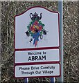
Welcome to Abram
Village sign on the A573 Image
Image: © Gerald England Taken: 18 Mar 2022
0.09 miles
3
Junction of the A58 and A573
The A58 bears right at Platt Bridge towards Ashton in Makerfield while the A573 continues through Abram towards Warrington.
Image: © Gerald England Taken: 18 Mar 2022
0.09 miles
4
Lily Lane (A58), Platt Bridge
Image: © JThomas Taken: 16 Feb 2013
0.12 miles
5
Holy Family Roman Catholic Church, Platt Bridge, Wigan
There's a memorial plaque in the porch to a former parish priest, Fr John F Kennedy, who died in 1981.
Image: © S Parish Taken: 13 Nov 2005
0.13 miles
6
Wigan Street, Platt Bridge
Image: © JThomas Taken: 16 Feb 2013
0.13 miles
7
Holy Family Catholic Church, Platt Bridge
Image: © David Dixon Taken: 23 Feb 2012
0.15 miles
8
Holy Family Roman Catholic Church, Platt Bridge
Image: © JThomas Taken: 16 Feb 2013
0.15 miles
9
Holy Family Roman Catholic Church, Platt Bridge
Image: © Roger Cornfoot Taken: 23 Jun 2018
0.15 miles
10
Holy Family Roman Catholic Church, Platt Bridge
The Parish was founded in 1893, previously having been served as a mission by priests from Saint William's Parish, Ince. The first church, erected in 1895 was second hand brought by canal and then carted-up past the site of the school in Wigan Street and on to Lily Lane by the men of the parish. The tin church was closed on 7th May 1959 and the congregation moved to Holy Family Parochial Hall, Toll Street. The foundation stone for the new Church was laid by the Most Reverend John Carmel Heenan Archbishop of Liverpool on 11th October 1959. It opened on 2nd December 1960. In 2016 the Church was refurbished and modernised.
Image: © Gerald England Taken: 18 Mar 2022
0.15 miles