
IMAGES TAKEN NEAR TO
Walmesley Drive, WIGAN, WN2 2LN
Introduction
This page details the photographs taken nearby to Walmesley Drive, WN2 2LN by members of the Geograph project.
The Geograph project started in 2005 with the aim of publishing, organising and preserving representative images for every square kilometre of Great Britain, Ireland and the Isle of Man.

There are currently over 7.5m images from over14,400 individuals and you can help contribute to the project by visiting https://www.geograph.org.uk
Image Map
Images are licensed for reuse under creativecommons.org/licenses/by-sa/2.0
Notes
- Clicking on the map will re-center to the selected point.
- The higher the marker number, the further away the image location is from the centre of the postcode.
Image Listing (23 Images Found)
Images are licensed for reuse under creativecommons.org/licenses/by-sa/2.0
Image
Details
Distance
1
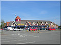
Supermarkitsch
Rumours that Morrisons Supermarkets use the same architect as Disney are an urban myth (started by me!). This building makes a substantial impact (blot) on its gridsquare.
Image: © David Hignett
Taken: 12 Sep 2005
0.05 miles
2
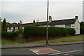
Island Row, off Petticoat Lane, Higher Ince
Petticoat Lane is now lined with 1920s Council Houses and more modern houses. In the 1920s there were around 60 dwellings there, which were cleared away, presumably as substandard housing. This nearby row remains. A local Mothers' Union trip to York in 1929 declared the famous Shambles to be 'no nicer than Petticoat Lane', which implies the demolished houses here looked quite quaint and attractive.
Image: © David Long
Taken: 3 Jun 2009
0.15 miles
3
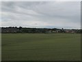
Field between Makerfield Way and the railway
Older maps call this area, including the part now covered by Morrison's supermarket and a housing estate in the background, The Square.
Image: © Stephen Craven
Taken: 2 Jul 2016
0.18 miles
4
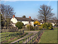
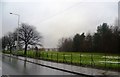
House Opposite Walmesley Park
The green area between Manchester Road (A577) and Makerfield Way, opposite Walmesley Park.
Image: © David Dixon
Taken: 28 Mar 2012
0.19 miles
7

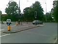
Makerfield Way
Bridge carrying Makerfield Way across an old railway line.
Image: © Peter McDermott
Taken: 10 Sep 2016
0.19 miles
8
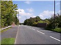
Makerfield Way bridges the dismantled whelley loop railway
Image: © Raymond Knapman
Taken: 3 Sep 2010
0.19 miles
9
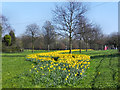
Daffodils on the Green
The green area between Manchester Road (A577) and Makerfield Way, opposite Walmesley Park.
Image: © David Dixon
Taken: 28 Mar 2012
0.19 miles
10
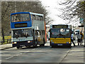
Manchester Road (A577)
R250 NBV, Stagecoach Lancashire’s Alexander bodied, Volvo Olympian double decker (fleet number 16650), passes the Dennis Dart (EK51 XXG) which has stopped to pick up passengers at the bus stop opposite Walmsley Park.
Image: © David Dixon
Taken: 28 Mar 2012
0.20 miles