IMAGES TAKEN NEAR TO
St. Elizabeths Road, WIGAN, WN2 1SJ
Introduction
This page details the photographs taken nearby to St. Elizabeths Road, WN2 1SJ by members of the Geograph project.
The Geograph project started in 2005 with the aim of publishing, organising and preserving representative images for every square kilometre of Great Britain, Ireland and the Isle of Man.

There are currently over 7.5m images from over14,400 individuals and you can help contribute to the project by visiting https://www.geograph.org.uk
Image Map
Images are licensed for reuse under creativecommons.org/licenses/by-sa/2.0
Notes
- Clicking on the map will re-center to the selected point.
- The higher the marker number, the further away the image location is from the centre of the postcode.
Image Listing (17 Images Found)
Images are licensed for reuse under creativecommons.org/licenses/by-sa/2.0
Image
Details
Distance
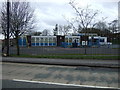
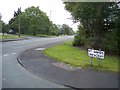
3
Our Lady's RC Primary School, Haigh & Aspull
At the junction of Holly Road with Haigh Road. I don't know what the significance of the concrete figure of an ostrich is, seen to the right of the pedestrian.
Image: © David Long
Taken: 8 Jul 2008
0.18 miles
4
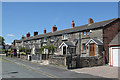
Cottages on Ratcliffe Road
Probably built as part of the earliest phase of development of coal mining in the area.
Image: © Alan Murray-Rust
Taken: 4 Jun 2013
0.19 miles
5

Cottages on Ratcliffe Road
Probably built as part of the earliest phase of development of coal mining in the area.
Image: © Alan Murray-Rust
Taken: 4 Jun 2013
0.19 miles
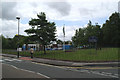
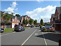
6
Haigh Road from St Davids Crescent at Aspull
Image: © Raymond Knapman
Taken: 23 May 2011
0.19 miles
7
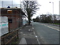
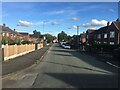
Haigh Road (B5239), Aspull
Heading south east.
Image: © JThomas
Taken: 28 Mar 2015
0.20 miles
8

No golfing allowed
Not that anyone would choose to play golf with vegetation like this to contend with!
Image: © Alan Murray-Rust
Taken: 4 Jun 2013
0.20 miles
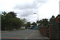
9
Holly Nook
A cul-de-sac of modern housing off Haigh Road built on former colliery land.
Image: © Kevin Waterhouse
Taken: 23 Jul 2024
0.21 miles
10
My ride homewards
The 575 bus from Bolton turns off Haigh Road into St David's Crescent.
Image: © David Long
Taken: 8 Jul 2008
0.21 miles