IMAGES TAKEN NEAR TO
Highfield Grove, WIGAN, WN2 1SG
Introduction
This page details the photographs taken nearby to Highfield Grove, WN2 1SG by members of the Geograph project.
The Geograph project started in 2005 with the aim of publishing, organising and preserving representative images for every square kilometre of Great Britain, Ireland and the Isle of Man.

There are currently over 7.5m images from over14,400 individuals and you can help contribute to the project by visiting https://www.geograph.org.uk
Image Map
Images are licensed for reuse under creativecommons.org/licenses/by-sa/2.0
Notes
- Clicking on the map will re-center to the selected point.
- The higher the marker number, the further away the image location is from the centre of the postcode.
Image Listing (54 Images Found)
Images are licensed for reuse under creativecommons.org/licenses/by-sa/2.0
Image
Details
Distance
1
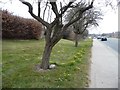
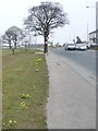
Dwarf daffodils along Wigan Road, Aspull
A sign of spring on the B5238.
Image: © Christine Johnstone
Taken: 10 Apr 2013
0.06 miles
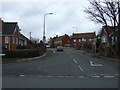
2
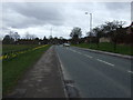
Wigan Road (B5238), Aspull
Heading south west.
Image: © JThomas
Taken: 28 Mar 2015
0.08 miles
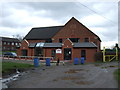
3
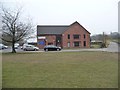
Aspull Methodist Church
On Crawford Street, off the Wigan Road.
Image: © Christine Johnstone
Taken: 10 Apr 2013
0.11 miles
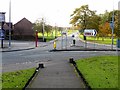
5
Pavement diversion, Wigan Road, Aspull
Looping round the back of two roadside trees.
Image: © Christine Johnstone
Taken: 10 Apr 2013
0.11 miles
6
Holly Road, Aspull
Looking north from Wigan Road (B5238).
Image: © JThomas
Taken: 28 Mar 2015
0.12 miles
7
Wigan Road, Aspull
From the war memorial garden.
Image: © philandju
Taken: 12 Nov 2013
0.12 miles
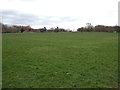
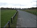
9
Woods Road, Aspull
Cutting south through the recreation ground, from the Wigan Road.
Image: © Christine Johnstone
Taken: 10 Apr 2013
0.13 miles
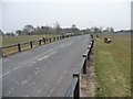
10
Road to Civic Hall, Aspull
Off Wigan Road (B5238).
Image: © JThomas
Taken: 28 Mar 2015
0.13 miles