
IMAGES TAKEN NEAR TO
Mill Court, WIGAN, WN2 1RB
Introduction
This page details the photographs taken nearby to Mill Court, WN2 1RB by members of the Geograph project.
The Geograph project started in 2005 with the aim of publishing, organising and preserving representative images for every square kilometre of Great Britain, Ireland and the Isle of Man.

There are currently over 7.5m images from over14,400 individuals and you can help contribute to the project by visiting https://www.geograph.org.uk
Image Map
Images are licensed for reuse under creativecommons.org/licenses/by-sa/2.0
Notes
- Clicking on the map will re-center to the selected point.
- The higher the marker number, the further away the image location is from the centre of the postcode.
Image Listing (22 Images Found)
Images are licensed for reuse under creativecommons.org/licenses/by-sa/2.0
Image
Details
Distance
1

New homes in a new street at Millbrook Close
On Mill Lane, formerly a footpath and farm track.
Image: © Christine Johnstone
Taken: 3 Jul 2013
0.07 miles
2
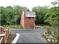
Electricity sub-station, Millbrook Close
Compare with Image taken six years earlier, before the new houses were built.
Image: © Christine Johnstone
Taken: 3 Jul 2013
0.08 miles
3
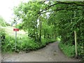
Track and footpath to Bank Top Farm
At the northern end of Borsdane Woods, near Millbrook Close.
Image: © Christine Johnstone
Taken: 3 Jul 2013
0.09 miles
4
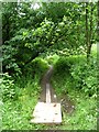
Boardwalk on footpath to Dodd's Farm
It has a temporary look about it, but it does work well.
Image: © Christine Johnstone
Taken: 3 Jul 2013
0.12 miles
5

Dicconson Mill Bridge
Crossing from Aspull into the township of Westhoughton.
Image: © David Dixon
Taken: 13 Feb 2012
0.12 miles
6

Dicconson Lane
Approaching Westhoughton from Aspull
Image: © David Dixon
Taken: 13 Feb 2012
0.13 miles

8

Boundary Stone
The boundary marker on Dicconson Mill Bridge, between Aspull and Westhoughton.
Image: © David Dixon
Taken: 13 Feb 2012
0.13 miles
9

Old Boundary Marker by the B5239 Dicconson Lane
Parish Boundary Marker set in a stone wall on the north side of the B5239 Dicconson Lane, between Dicconson Mill Bridge and the junction with Mill Lane. Aspull and Westhoughton parishes were townships in Wigan and Deane parishes respectively until 1866. Aspull parish was abolished in 1974.
Inscription reads:-
DIVISION
TOWNSHIP | TOWNSHIP
OF | OF
ASPULL | WEST -
. . . . . . . . . . . . . | HOUGHTON
← │ →
Milestone Society National ID: LA_ASPWHO01pb
Image: © Milestone Society
Taken: 1 Jan 2012
0.14 miles
10

Another pub under threat?
The FOR SALE sign looks ominous....
Image: © David Long
Taken: 1 Jun 2009
0.14 miles