IMAGES TAKEN NEAR TO
Wood Moor Road, PONTEFRACT, WF9 4JR
Introduction
This page details the photographs taken nearby to Wood Moor Road, WF9 4JR by members of the Geograph project.
The Geograph project started in 2005 with the aim of publishing, organising and preserving representative images for every square kilometre of Great Britain, Ireland and the Isle of Man.

There are currently over 7.5m images from over14,400 individuals and you can help contribute to the project by visiting https://www.geograph.org.uk
Image Map
Images are licensed for reuse under creativecommons.org/licenses/by-sa/2.0
Notes
- Clicking on the map will re-center to the selected point.
- The higher the marker number, the further away the image location is from the centre of the postcode.
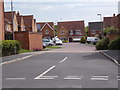
Image Listing (71 Images Found)
Images are licensed for reuse under creativecommons.org/licenses/by-sa/2.0
Image
Details
Distance
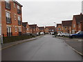
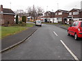
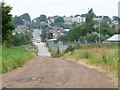
1
Wood Moor Road - looking towards Lowfield Road
Image: © Betty Longbottom
Taken: 17 Feb 2017
0.03 miles

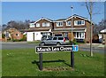
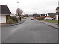
6
Marsh Lea Grove
On the north side of Lowfield Road, Hemsworth.
Image: © Christine Johnstone
Taken: 1 Aug 2012
0.08 miles
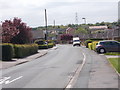
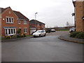
7
Lowfield Road, Hemsworth
At the railway bridge changing from an unmetalled access track [and public bridleway] into a suburban minor road.
Image: © Christine Johnstone
Taken: 1 Aug 2012
0.09 miles