IMAGES TAKEN NEAR TO
Grove Lane, PONTEFRACT, WF9 4BD
Introduction
This page details the photographs taken nearby to Grove Lane, WF9 4BD by members of the Geograph project.
The Geograph project started in 2005 with the aim of publishing, organising and preserving representative images for every square kilometre of Great Britain, Ireland and the Isle of Man.

There are currently over 7.5m images from over14,400 individuals and you can help contribute to the project by visiting https://www.geograph.org.uk
Image Map
Images are licensed for reuse under creativecommons.org/licenses/by-sa/2.0
Notes
- Clicking on the map will re-center to the selected point.
- The higher the marker number, the further away the image location is from the centre of the postcode.
Image Listing (82 Images Found)
Images are licensed for reuse under creativecommons.org/licenses/by-sa/2.0
Image
Details
Distance
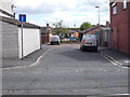
5
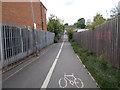
Footpath & Cycle Way - Grove Terrace
Image: © Betty Longbottom
Taken: 30 May 2015
0.05 miles
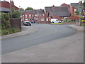
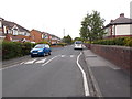
6
Grove Terrace - looking towards Grove Lane
Image: © Betty Longbottom
Taken: 30 May 2015
0.05 miles
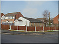
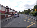
8
Grove Lea Primary School - Grove Terrace
Image: © Betty Longbottom
Taken: 30 May 2015
0.08 miles
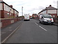
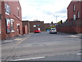
9
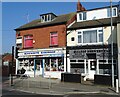
Hemsworth Hardware Store on Kirkby Road
Image: © Neil Theasby
Taken: 8 Mar 2022
0.08 miles