
IMAGES TAKEN NEAR TO
The Leys, PONTEFRACT, WF9 3UY
Introduction
This page details the photographs taken nearby to The Leys, WF9 3UY by members of the Geograph project.
The Geograph project started in 2005 with the aim of publishing, organising and preserving representative images for every square kilometre of Great Britain, Ireland and the Isle of Man.

There are currently over 7.5m images from over14,400 individuals and you can help contribute to the project by visiting https://www.geograph.org.uk
Image Map
Images are licensed for reuse under creativecommons.org/licenses/by-sa/2.0
Notes
- Clicking on the map will re-center to the selected point.
- The higher the marker number, the further away the image location is from the centre of the postcode.
Image Listing (18 Images Found)
Images are licensed for reuse under creativecommons.org/licenses/by-sa/2.0
Image
Details
Distance
1

Stockingate Primary School playground
With a multi-funnel for ball games and a chequerboard for outdoor draughts.
Image: © Christine Johnstone
Taken: 1 Aug 2012
0.07 miles
2
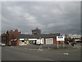
McColls @ The Old Mill
This is the same site as Image (and earlier photos) at the south end of Mill Lane
Image: © John Slater
Taken: 6 Mar 2016
0.09 miles
3
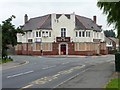
The Old Mill, closed and for sale
Image: © Christine Johnstone
Taken: 1 Aug 2012
0.09 miles
4
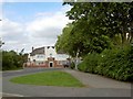
The Old Mill public house, South Kirkby
Taken from the junction of Broad Lane with Stockingate.
Image: © Steve Fareham
Taken: 3 Jun 2009
0.09 miles
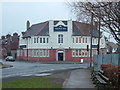
6
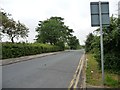
Broad Lane, South Kirkby
Not living up to its name past the entrance to the school playground.
Image: © Christine Johnstone
Taken: 1 Aug 2012
0.10 miles
7
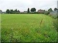
At the junction of Common Road and Broad Lane
With security fencing but no signs, possibly a recreation ground.
Image: © Christine Johnstone
Taken: 1 Aug 2012
0.13 miles
8
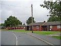
Mill Close, South Kirkby
A tangle of bungalows on the north side of Common Road.
Image: © Christine Johnstone
Taken: 1 Aug 2012
0.14 miles
9
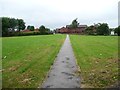
Path to Holmsley Avenue, South Kirkby
Running north from Common Road.
Image: © Christine Johnstone
Taken: 1 Aug 2012
0.15 miles
10
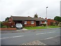
Bungalows in Mill Close, South Kirkby
At the junction with Common Road.
Image: © Christine Johnstone
Taken: 1 Aug 2012
0.15 miles