
IMAGES TAKEN NEAR TO
Lidgate Crescent, PONTEFRACT, WF9 3NR
Introduction
This page details the photographs taken nearby to Lidgate Crescent, WF9 3NR by members of the Geograph project.
The Geograph project started in 2005 with the aim of publishing, organising and preserving representative images for every square kilometre of Great Britain, Ireland and the Isle of Man.

There are currently over 7.5m images from over14,400 individuals and you can help contribute to the project by visiting https://www.geograph.org.uk
Image Map
Images are licensed for reuse under creativecommons.org/licenses/by-sa/2.0
Notes
- Clicking on the map will re-center to the selected point.
- The higher the marker number, the further away the image location is from the centre of the postcode.
Image Listing (11 Images Found)
Images are licensed for reuse under creativecommons.org/licenses/by-sa/2.0
Image
Details
Distance
2

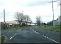
Bridge SMJ 2/52 - Moorthorpe Station
Image: © Betty Longbottom
Taken: 9 Jun 2009
0.18 miles
3

View from a stopped train
South Elmsall is no Adlestrop Image and modern trains have no opening windows to admit birdsong. But the view from our late-running local train, paused on the goods loop to let a long-distance train pass us to keep time, was pleasant enough, though we ended up missing our connection in Sheffield by a minute.
Image: © Stephen Craven
Taken: 12 Jul 2025
0.19 miles
4

View from Bridge SMJ 2/52 - Barnsley Road
Image: © Betty Longbottom
Taken: 9 Jun 2009
0.20 miles
5
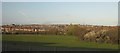
Langthwaite Common
Grazing land at Moorthorpe. Across the valley of the Langthwaite Beck is South Elmsall. The terrace on the left is on Wesley Street, under which the beck is culverted. Flooding in 2007 was combatted http://www.wakefield.gov.uk/Environment/Land/LandDrainage/langthwaitebeck.htm by increasing the size of a pond beside the beck, here hidden by trees.
View from a train between Sheffield and York approaching Moorthorpe station, 500 metres to the north (left), which had been diverted away from the Wakefield / Leeds route because of signalling problems.
Image: © Derek Harper
Taken: 31 Mar 2012
0.21 miles

8

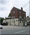
View from Bridge SMJ 2/52 - Barnsley Road
Image: © Betty Longbottom
Taken: 9 Jun 2009
0.23 miles

10
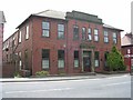
Park View Apartments - Barnsley Road
Image: © Betty Longbottom
Taken: 9 Jun 2009
0.24 miles