
IMAGES TAKEN NEAR TO
Walton Road, PONTEFRACT, WF9 1JD
Introduction
This page details the photographs taken nearby to Walton Road, WF9 1JD by members of the Geograph project.
The Geograph project started in 2005 with the aim of publishing, organising and preserving representative images for every square kilometre of Great Britain, Ireland and the Isle of Man.

There are currently over 7.5m images from over14,400 individuals and you can help contribute to the project by visiting https://www.geograph.org.uk
Image Map
Images are licensed for reuse under creativecommons.org/licenses/by-sa/2.0
Notes
- Clicking on the map will re-center to the selected point.
- The higher the marker number, the further away the image location is from the centre of the postcode.
Image Listing (12 Images Found)
Images are licensed for reuse under creativecommons.org/licenses/by-sa/2.0
Image
Details
Distance
1
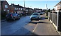
Western end, Harewood Lane, Upton
This, the western end, is a built up road. The rest of the lane is an unpaved bridleway.
Image: © Christine Johnstone
Taken: 9 Feb 2015
0.06 miles
2
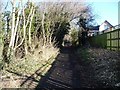
Harewood Lane, north of Woodlands Way, Upton
The lane runs from Upton to the A639. The western end is a metalled road with houses, but most of it is a track along the boundary of Walton Wood. It is a public bridleway.
Image: © Christine Johnstone
Taken: 9 Feb 2015
0.06 miles
3
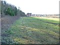
The north-western boundary of Walton Wood
Looking towards the first / last house in Harewood Lane.
Image: © Christine Johnstone
Taken: 9 Feb 2015
0.08 miles
4
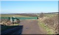
Track to Bullcar Plantation
Running north from Harewood Lane.
Image: © Christine Johnstone
Taken: 9 Feb 2015
0.09 miles
5
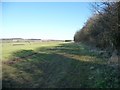
Farmland on the north-west side of Walton Wood
Seen from the exit of an informal path dropping down through the wood from Harewood Lane.
Image: © Christine Johnstone
Taken: 9 Feb 2015
0.10 miles
6
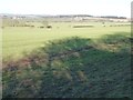
Walton Wood's shadows on farmland near Upton
Looking north at about mid-day in early February.
Image: © Christine Johnstone
Taken: 9 Feb 2015
0.11 miles
8

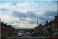
Rainy, Sunny, Cloudy, Rainbowy, 4 Seasons in one day . . .
Here's the Upton Mast on the afternoon of a picturesque, weather-filled July day, 2005.
Image: © Paul Johnston-Knight
Taken: 27 Jul 2005
0.17 miles
9
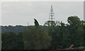
Communications tower
Seen from New Road Badsworth, this is the tower at Upton (Image)
A long-range view taken with the Samsung NX500 using the 50..200mm lens at 200mm, equivalent to 300mm on a 35mm SLR
Image: © Bob Harvey
Taken: 9 Sep 2016
0.23 miles
10
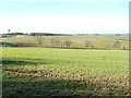
A low hill north of Upton
With a spot height of 72 metres. Is this natural, or the remains of a spoil heap?
Image: © Christine Johnstone
Taken: 9 Feb 2015
0.23 miles