
IMAGES TAKEN NEAR TO
Main Street, PONTEFRACT, WF9 1EH
Introduction
This page details the photographs taken nearby to Main Street, WF9 1EH by members of the Geograph project.
The Geograph project started in 2005 with the aim of publishing, organising and preserving representative images for every square kilometre of Great Britain, Ireland and the Isle of Man.

There are currently over 7.5m images from over14,400 individuals and you can help contribute to the project by visiting https://www.geograph.org.uk
Image Map
Images are licensed for reuse under creativecommons.org/licenses/by-sa/2.0
Notes
- Clicking on the map will re-center to the selected point.
- The higher the marker number, the further away the image location is from the centre of the postcode.
Image Listing (8 Images Found)
Images are licensed for reuse under creativecommons.org/licenses/by-sa/2.0
Image
Details
Distance
2
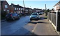
Western end, Harewood Lane, Upton
This, the western end, is a built up road. The rest of the lane is an unpaved bridleway.
Image: © Christine Johnstone
Taken: 9 Feb 2015
0.18 miles
4

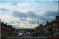
Where a railway bridge once stood
Near Upton . The railway in question was, according to another Geograph contributor, the former Hull, Barnsley and West Riding Junction Railway. See https://www.geograph.org.uk/photo/2640514
Image: © Neil Theasby
Taken: 8 Aug 2019
0.22 miles

6
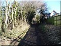
Harewood Lane, north of Woodlands Way, Upton
The lane runs from Upton to the A639. The western end is a metalled road with houses, but most of it is a track along the boundary of Walton Wood. It is a public bridleway.
Image: © Christine Johnstone
Taken: 9 Feb 2015
0.23 miles
7
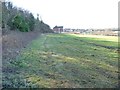
The north-western boundary of Walton Wood
Looking towards the first / last house in Harewood Lane.
Image: © Christine Johnstone
Taken: 9 Feb 2015
0.24 miles
8
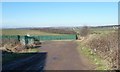
Track to Bullcar Plantation
Running north from Harewood Lane.
Image: © Christine Johnstone
Taken: 9 Feb 2015
0.25 miles