
IMAGES TAKEN NEAR TO
Navigation Walk, WAKEFIELD, WF90 8AB
Introduction
This page details the photographs taken nearby to Navigation Walk, WF90 8AB by members of the Geograph project.
The Geograph project started in 2005 with the aim of publishing, organising and preserving representative images for every square kilometre of Great Britain, Ireland and the Isle of Man.

There are currently over 7.5m images from over14,400 individuals and you can help contribute to the project by visiting https://www.geograph.org.uk
Image Map
Images are licensed for reuse under creativecommons.org/licenses/by-sa/2.0
Notes
- Clicking on the map will re-center to the selected point.
- The higher the marker number, the further away the image location is from the centre of the postcode.
Image Listing (479 Images Found)
Images are licensed for reuse under creativecommons.org/licenses/by-sa/2.0
Image
Details
Distance
1

Calder Canal, Wakefield
View under 2 road bridges over a section of the Calder canal near the city centre. This section of the canal provides a route for boats to avoid the weir in the main river Calder. The crane is indicative of the fact that this is yet another canal side location which has become fashionable for new developments.
Image: © John Goldsmith
Taken: 17 Nov 2007
0.01 miles
2

Waterfront buildings, Wakefield
Some of these warehouse buildings have been restored and converted, others are awaiting redevelopment.
Image: © Jim Osley
Taken: 30 Jun 2018
0.01 miles
3

Waiting at the lights
Steel frame by Leonard Cooper steel of Leeds for new apartments.
Image: © Steve Fareham
Taken: 3 Dec 2007
0.02 miles
4

Navigation Walk - off Bridge Street
Image: © Betty Longbottom
Taken: 25 Oct 2010
0.02 miles
5

Wakefield Lock - Calder & Hebble Navigation - from Bridge Street
Image: © Betty Longbottom
Taken: 1 Apr 2008
0.02 miles
6

New waterside development
Contractor Quarmby of Ilkley steel frame by Leonard Cooper Leeds and safety barriers by easi-edge Tuxford.
Image: © Steve Fareham
Taken: 10 Nov 2007
0.02 miles
7

Navigation House Wakefield East
Former warehouse on the east bank of the Reiver Calder navigation.
Image: © Phillip De-Vere
Taken: 3 Oct 2023
0.03 miles
8

Lock entrance to the River Calder at Wakefield
Image: © Steve Fareham
Taken: 10 Nov 2007
0.03 miles
9
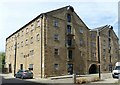
Calder and Hebble Navigation Warehouse, Wakefield
Originally two warehouses, built c.1790 probably as a transshipment centre to the Aire and Calder Navigation, combined into one in 1815. Well restored and converted to office accommodation. Listed Grade II*.
Image: © Alan Murray-Rust
Taken: 1 Jul 2018
0.03 miles
10

Navigation Walk, Wakefield
New build in the Wakefield waterfront area.
Image: © Jim Osley
Taken: 30 Jun 2018
0.03 miles