
IMAGES TAKEN NEAR TO
Meadow Bank, PONTEFRACT, WF7 7HW
Introduction
This page details the photographs taken nearby to Meadow Bank, WF7 7HW by members of the Geograph project.
The Geograph project started in 2005 with the aim of publishing, organising and preserving representative images for every square kilometre of Great Britain, Ireland and the Isle of Man.

There are currently over 7.5m images from over14,400 individuals and you can help contribute to the project by visiting https://www.geograph.org.uk
Image Map
Images are licensed for reuse under creativecommons.org/licenses/by-sa/2.0
Notes
- Clicking on the map will re-center to the selected point.
- The higher the marker number, the further away the image location is from the centre of the postcode.
Image Listing (70 Images Found)
Images are licensed for reuse under creativecommons.org/licenses/by-sa/2.0
Image
Details
Distance



5

The Brown Cow Public House, Ackworth
Image: © Bill Henderson
Taken: 22 Aug 2006
0.06 miles
6
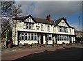
How now "Brown Cow"!
"The Brown Cow" public house in High Ackworth
Image: © Neil Theasby
Taken: 26 Mar 2015
0.06 miles
7
Coloured houses in Ackworth at night
Image: © Jonathan Thacker
Taken: 13 Feb 2018
0.07 miles
8

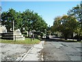
Pontefract Road (A628), High Ackworth
The A628 runs from Hollingworth to Pontefract by way of the Woodhead Pass and Barnsley. The section through High Ackworth is relatively narrow and twisty and the response to a campaign for an Ackworth by-pass in the 1980s to divert what was then a trunk road around the village was to "de-trunk" it! This road scene shows the road as it nears the last sharp left-hand bend before it turns North to leave the village for Pontefract.
Image: © Robert Neilson
Taken: 11 Feb 2007
0.07 miles
9

The Manor House, High Ackworth
Early nineteenth century house https://www.britishlistedbuildings.co.uk/101298817-manor-house-including-rear-outbuilding-wing-and-attached-mounting-block-ackworth#.Wo3l0ufLjVI
Image: © Jonathan Thacker
Taken: 19 Feb 2018
0.08 miles
10
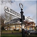
Direction Sign ? Signpost
Located on the edge of a grass triangle on the north side of the junction of the A628 Pontefract Road and the B6421 Purston Lane in Ackworth parish. 3 arms and annulus finial.
Milestone Society National ID: YW_SE4417
Image: © C Minto
Taken: 30 Dec 2018
0.08 miles