
IMAGES TAKEN NEAR TO
Parkers Fold, PONTEFRACT, WF7 7FY
Introduction
This page details the photographs taken nearby to Parkers Fold, WF7 7FY by members of the Geograph project.
The Geograph project started in 2005 with the aim of publishing, organising and preserving representative images for every square kilometre of Great Britain, Ireland and the Isle of Man.

There are currently over 7.5m images from over14,400 individuals and you can help contribute to the project by visiting https://www.geograph.org.uk
Image Map
Images are licensed for reuse under creativecommons.org/licenses/by-sa/2.0
Notes
- Clicking on the map will re-center to the selected point.
- The higher the marker number, the further away the image location is from the centre of the postcode.
Image Listing (60 Images Found)
Images are licensed for reuse under creativecommons.org/licenses/by-sa/2.0
Image
Details
Distance
1

Not so Reliant Robins
Was the owner trying to get one from five I wonder? With thanks to Avocet for the title.
Image: © Mike Kirby
Taken: 27 Aug 2008
0.09 miles
2
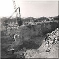
Brackenhill Quarries
Quarrying is believed to have begun here in 1629 when Charles I granted quarrying rights to tenants to take stone for use within the Manor. The hard course-grained sandstone was not only good building material but could be used for grindstones and scythe stones and by the 1800s it was exported worldwide.
Image: © Gerald England
Taken: Unknown
0.10 miles

4
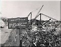
Brackenhill Quarries
Quarrying is believed to have begun here in 1629 when Charles I granted quarrying rights to tenants to take stone for use within the Manor. The hard course-grained sandstone was not only good building material but could be used for grindstones and scythe stones and by the 1800s it was exported worldwide.
Image: © Gerald England
Taken: Unknown
0.12 miles
5

The Angel
This pub serves excellent food all week, and a carvery operates on Sunday lunchtimes.
Image: © Mike Kirby
Taken: 17 Aug 2008
0.12 miles
7

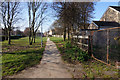
Subway under Wakefield Road
Leaving Fitzwilliam country park.
Image: © Steve Fareham
Taken: 18 Apr 2009
0.13 miles
8
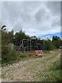
Off Green Lane, Brackenhill
Possible old quarrying equipment
Image: © thejackrustles
Taken: 12 Oct 2021
0.13 miles
9

Underpass
This underpass goes under Wakefield Road, taking the walkway, Dando Way, all the way to Fitzwilliam Country Park.
Image: © Mike Kirby
Taken: 27 Aug 2008
0.14 miles
10

Stone built terrace
More stone built houses in Ackworth. This row sits behind the Angel pub.
Image: © Mike Kirby
Taken: 27 Aug 2008
0.15 miles