
IMAGES TAKEN NEAR TO
Pontefract Road, PONTEFRACT, WF7 7ET
Introduction
This page details the photographs taken nearby to Pontefract Road, WF7 7ET by members of the Geograph project.
The Geograph project started in 2005 with the aim of publishing, organising and preserving representative images for every square kilometre of Great Britain, Ireland and the Isle of Man.

There are currently over 7.5m images from over14,400 individuals and you can help contribute to the project by visiting https://www.geograph.org.uk
Image Map
Images are licensed for reuse under creativecommons.org/licenses/by-sa/2.0
Notes
- Clicking on the map will re-center to the selected point.
- The higher the marker number, the further away the image location is from the centre of the postcode.
Image Listing (11 Images Found)
Images are licensed for reuse under creativecommons.org/licenses/by-sa/2.0
Image
Details
Distance
1
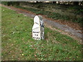
Barnsley 12 miles
Milestone marker, Castle Syke Hill, Ackworth.
Image: © Bill Henderson
Taken: 16 Oct 2007
0.19 miles


4

Public Footpath
This is the view of the public footpath from Purston as it approaches Castle Syke Hill, Ackworth.
Image: © Bill Henderson
Taken: 16 Oct 2007
0.22 miles
5

Ackworth Water Tower
As the village of Ackworth grew significantly in the 1970s with several large new housing developments, water pressure became a problem. The solution was to give Ackworth a water tower of its own. Previously the water tower at Pontefract had provided the pressure regulating facility, but Pontefract too had seen significant housing development and some parts of Ackworth were literally on the end of the line, about 5 miles from the Pontefract tower.
Ackworth Water Tower is located at the top of Castle Syke Hill, just off the A628 Pontefract Road. The immediate effect of the pressure improvement was a series of mains bursts over many months all the way down the water main under the A628 as it ran through Ackworth. The water main had obviously deteriorated over time but the low pressure had concealed the problem. Any repair cascaded the problem to the next weakest point. Eventually a full water main renewal, at considerable disruption to local traffic, was the solution.
Image: © Robert Neilson
Taken: 11 Feb 2007
0.23 miles
6
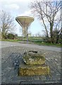
Ackworth Plague Stone
And behind it Ackworth Water Tower. The Plague Stone allegedly dates back to the local plague of 1645. It is said that alms in the form of coins were placed in the hollow basin at the top to be disinfected in vinegar.
Image: © Neil Theasby
Taken: 26 Mar 2015
0.24 miles

8

Castle Syke Hill, Ackworth. The Water Tower
This is the highest point in Ackworth, traditionally where water towers are situated.
Image: © Bill Henderson
Taken: 22 Aug 2006
0.25 miles
9
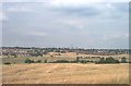
Castle Syke Hill, View from the base of the Water Tower
This is the view from Castle Syke Hill, Ackworth, the base of the Water Tower, looking over Pontefract to Ferrybridge Power station on the horizon.
Image: © Bill Henderson
Taken: 22 Aug 2006
0.25 miles
10

Ackworth Plague Stone
Ackworth Plague Stone is associated with the outbreak of plague that affected Ackworth in 1645. The hollow on top that now fills with rain water was filled with vinegar at the time as a disinfectant for coins left in it as payment for goods brought to the village boundary from the local market town of Pontefract.
Image: © Robert Neilson
Taken: 3 Dec 2006
0.25 miles