
IMAGES TAKEN NEAR TO
The Elms, PONTEFRACT, WF7 7DZ
Introduction
This page details the photographs taken nearby to The Elms, WF7 7DZ by members of the Geograph project.
The Geograph project started in 2005 with the aim of publishing, organising and preserving representative images for every square kilometre of Great Britain, Ireland and the Isle of Man.

There are currently over 7.5m images from over14,400 individuals and you can help contribute to the project by visiting https://www.geograph.org.uk
Image Map
Images are licensed for reuse under creativecommons.org/licenses/by-sa/2.0
Notes
- Clicking on the map will re-center to the selected point.
- The higher the marker number, the further away the image location is from the centre of the postcode.
Image Listing (115 Images Found)
Images are licensed for reuse under creativecommons.org/licenses/by-sa/2.0
Image
Details
Distance

2

Ackworth War Memorial
Ackworth War Memorial was constructed as a Millennium Project by the people of Ackworth and is situated on the South Western edge of the Ackworth Moor Top roundabout. This view is from the rear, looking towards the North East, with the Beverley Arms Public House and Restaurant just partly visible in the background across the roundabout.
Image: © Robert Neilson
Taken: 17 Dec 2006
0.03 miles
3

Ackworth Carnival
Marching down Wakefield Road.
Image: © Gerald England
Taken: 25 Jun 1994
0.04 miles
4

Chiltern Drive
A street consisting mainly of local-authority-owned, warden-controlled bungalows for housing elderly persons - commonly referred to as "owd-folk's bungalows". At the end of Hawthorn Grove is a group of flats which includes the warden's residence.
Image: © Gerald England
Taken: 19 Jul 1992
0.04 miles

6

Recycling
The good people of Ackworth take recycling seriously as everything has to be taken to this site. Wakefield MDC have not yet introduced a recycling scheme in this area.
Image: © Mike Kirby
Taken: 27 Aug 2008
0.06 miles
7

Chiltern Drive
A street consisting mainly of local-authority-owned, warden-controlled bungalows for housing elderly persons - commonly referred to as "owd-folk's bungalows".
Image: © Gerald England
Taken: 19 Jul 1992
0.06 miles
8
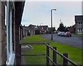
Chiltern Drive
A street consisting mainly of local-authority-owned, warden-controlled bungalows for housing elderly persons - commonly referred to as "owd-folk's bungalows".
Image: © Gerald England
Taken: 19 Jul 1992
0.07 miles
9
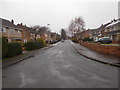
Chiltern Drive - looking towards Wakefield Road
Image: © Betty Longbottom
Taken: 16 Jan 2017
0.08 miles
10

Barnsley Road - viewed from Chiltern Drive
Image: © Betty Longbottom
Taken: 16 Jan 2017
0.08 miles