IMAGES TAKEN NEAR TO
Fair View, PONTEFRACT, WF7 7DA
Introduction
This page details the photographs taken nearby to Fair View, WF7 7DA by members of the Geograph project.
The Geograph project started in 2005 with the aim of publishing, organising and preserving representative images for every square kilometre of Great Britain, Ireland and the Isle of Man.

There are currently over 7.5m images from over14,400 individuals and you can help contribute to the project by visiting https://www.geograph.org.uk
Image Map
Images are licensed for reuse under creativecommons.org/licenses/by-sa/2.0
Notes
- Clicking on the map will re-center to the selected point.
- The higher the marker number, the further away the image location is from the centre of the postcode.
Image Listing (19 Images Found)
Images are licensed for reuse under creativecommons.org/licenses/by-sa/2.0
Image
Details
Distance
1
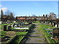
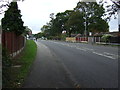
Cemetery and cottages., Ackworth Moor Top
Image: © Jonathan Thacker
Taken: 10 Feb 2016
0.00 miles
2
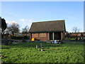
Ackworth Cemetery
The cemetery opened in 1941 and this was probably built as a cemetery chapal.
Image: © Jonathan Thacker
Taken: 10 Feb 2016
0.07 miles
3
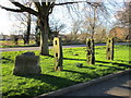
Ackworth tenter poles
Used in the drying and stretching of flax or skins. Probably date from the eighteenth century.
Image: © Jonathan Thacker
Taken: 10 Feb 2016
0.08 miles
4
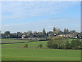
Ackworth Cemetery, from the track to Moor House.
Image: © Bill Henderson
Taken: 7 Nov 2006
0.10 miles
8
![Charlestown Estate [south east]](https://s3.geograph.org.uk/geophotos/02/50/28/2502807_0dc3d8ac_120x120.jpg)
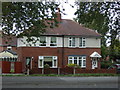
Charlestown Estate [south east]
This area doesn't have road names, it is all called Charlestown Estate.
Image: © Christine Johnstone
Taken: 12 Jul 2011
0.20 miles
9
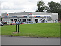
Suzuki Dealership
Stoneacres are one of two Suzuki dealerships in West Yorkshire, located across the roundabout from the garden centre.
Image: © Mike Kirby
Taken: 17 Aug 2008
0.21 miles
10
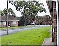
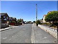
Chiltern Drive
A street consisting mainly of local-authority-owned, warden-controlled bungalows for housing elderly persons - commonly referred to as "owd-folk's bungalows". It leads off Barnsley Road opposite the Catholic Church.
Image: © Gerald England
Taken: 19 Jul 1992
0.22 miles