
IMAGES TAKEN NEAR TO
Doncaster Road Estate, PONTEFRACT, WF7 7BY
Introduction
This page details the photographs taken nearby to Doncaster Road Estate, WF7 7BY by members of the Geograph project.
The Geograph project started in 2005 with the aim of publishing, organising and preserving representative images for every square kilometre of Great Britain, Ireland and the Isle of Man.

There are currently over 7.5m images from over14,400 individuals and you can help contribute to the project by visiting https://www.geograph.org.uk
Image Map
Images are licensed for reuse under creativecommons.org/licenses/by-sa/2.0
Notes
- Clicking on the map will re-center to the selected point.
- The higher the marker number, the further away the image location is from the centre of the postcode.
Image Listing (41 Images Found)
Images are licensed for reuse under creativecommons.org/licenses/by-sa/2.0
Image
Details
Distance
3
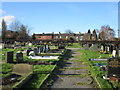
Cemetery and cottages., Ackworth Moor Top
Image: © Jonathan Thacker
Taken: 10 Feb 2016
0.09 miles
5
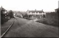
Mill Lane
The level crossing on Mill Lane. The line was the Brackenhill Light Railway. It ran from Brackenhill Jn on the Sheffield to York line to Hemsworth Colliery (with a short spur to Ackworth Moor Top). It never carried a passenger service although it saw occasional holiday excursions. The NER worked the line but to avoid requiring the sanction of the Board of Trade this was never formalised. It was absorbed by the LNER at the grouping and survived into BR days, closing at the end of 1961.
Image: © Gerald England
Taken: Unknown
0.15 miles
6

Suzuki Dealership
Stoneacres are one of two Suzuki dealerships in West Yorkshire, located across the roundabout from the garden centre.
Image: © Mike Kirby
Taken: 17 Aug 2008
0.15 miles
7
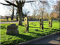
Ackworth tenter poles
Used in the drying and stretching of flax or skins. Probably date from the eighteenth century.
Image: © Jonathan Thacker
Taken: 10 Feb 2016
0.15 miles
8
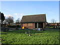
Ackworth Cemetery
The cemetery opened in 1941 and this was probably built as a cemetery chapal.
Image: © Jonathan Thacker
Taken: 10 Feb 2016
0.15 miles
9
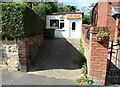
Lotus Garden, Mill Lane, Ackworth
A tiny Chinese takeaway, squeezed between houses at Ackworth Moor Top.
Image: © Neil Theasby
Taken: 3 Sep 2024
0.16 miles
10
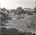
Abandoned Railway Line
The line of the abandoned and dismantled Brackenhill Light Railway from Mill Lane Image past the back of houses on Hillside Avenue towards Barnsley Road Image
The route later became a designated footpath, Jack Dando Way. See it in 2008 looking back from Barnsley Road. Image
Image: © Gerald England
Taken: Unknown
0.17 miles