
IMAGES TAKEN NEAR TO
Cutsyke Road, PONTEFRACT, WF7 6HY
Introduction
This page details the photographs taken nearby to Cutsyke Road, WF7 6HY by members of the Geograph project.
The Geograph project started in 2005 with the aim of publishing, organising and preserving representative images for every square kilometre of Great Britain, Ireland and the Isle of Man.

There are currently over 7.5m images from over14,400 individuals and you can help contribute to the project by visiting https://www.geograph.org.uk
Image Map
Images are licensed for reuse under creativecommons.org/licenses/by-sa/2.0
Notes
- Clicking on the map will re-center to the selected point.
- The higher the marker number, the further away the image location is from the centre of the postcode.
Image Listing (26 Images Found)
Images are licensed for reuse under creativecommons.org/licenses/by-sa/2.0
Image
Details
Distance
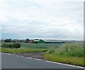

3
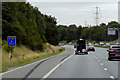
Eastbound M62 at Driver Location A 127.2
Passing Driver Location Sign (DLS) at M62 A127.2
Driver location signs are now widely used across the motorway and A–road network. First introduced in 2003, they complement distance marker posts. Both types of marker post display the distances in kilometres from a nominal start point but driver location signs are designed to be read by motorists or their passengers when, for instance, they need to pass details to the emergency services. They give the same location information as distance marker posts, but more visibly on larger signs. They are normally spaced at 500-metre intervals along the nearside verge but if obstacles (eg sliproads or bridges) prevent signs from being erected at these locations, then the interval is reduced to either 400 or 300 metres.
Driver location signs have three pieces of information:
• The road identifier (eg M62)
• The carriageway identifier – The letter on the second line of the signs, usually “A” or “B”, tells the emergency services or the Highways Agency in which direction you are travelling. The letter “A” ("Away from London") normally denotes carriageways leaving London (or clockwise in the case of the M25) and "B" ("Back to London") is used for carriageways going to London (anticlockwise on the M25).
• The location (which is identical to the location given on marker posts). Distances are accurate to within 20 metres and are generally quoted from the beginning of the motorway.
http://www.dft.gov.uk/ha/standards/ians/pdfs/ian93r1.pdf DFT Interim Advice Note (December 2010)
http://www.theaa.com/motoring_advice/breakdown_advice/driver-location-signs.html The AA
http://www.sabre-roads.org.uk/wiki/index.php?title=Driver_Location_Signs SABRE
Image: © David Dixon
Taken: 2 Aug 2015
0.06 miles
4
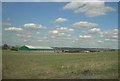
Low Laithe Farm
Low Laithe Farm and surrounding pasture land. The M62 runs just behind the farm.
Image: © Darren Haddock
Taken: 25 Aug 2006
0.07 miles
5
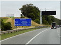
VMS on Eastbound M62 near Whitwood
Variable message signs, sometimes referred to as matrix signs, are electronic traffic signs used on motorways (and some other major routes) to give drivers information about special events and to warn them about traffic congestion, accidents, incidents, roadworks or speed limits on a specific sections of the route. They may also suggest (or instruct) drivers to take alternative routes, limit speed, warn of duration and location of the incidents or just inform of the traffic conditions.
Image: © David Dixon
Taken: 2 Aug 2015
0.08 miles
6
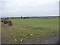
Arable land above Low Laithe Farm
Taken from Cutsyke Road.
Image: © Christine Johnstone
Taken: 2 Jan 2011
0.08 miles

8

View across the new roundabout
On the opposite side, Cutsyke Road drops down from Low Laithe Farm.
Image: © Christine Johnstone
Taken: 2 Jan 2011
0.13 miles
9

New road brings new roundabout
Three roads now meet on the south side of the M62 embankment, not two.
Image: © Christine Johnstone
Taken: 2 Jan 2011
0.14 miles
10

Urban street furniture on Cutsyke Road
The new road has brought pavements, dropped kerbs, refuges and bollards to what was previously [despite the nearby M62] a rural lane.
Image: © Christine Johnstone
Taken: 2 Jan 2011
0.14 miles