
IMAGES TAKEN NEAR TO
Ackton Wood Villas, PONTEFRACT, WF7 6HU
Introduction
This page details the photographs taken nearby to Ackton Wood Villas, WF7 6HU by members of the Geograph project.
The Geograph project started in 2005 with the aim of publishing, organising and preserving representative images for every square kilometre of Great Britain, Ireland and the Isle of Man.

There are currently over 7.5m images from over14,400 individuals and you can help contribute to the project by visiting https://www.geograph.org.uk
Image Map
Images are licensed for reuse under creativecommons.org/licenses/by-sa/2.0
Notes
- Clicking on the map will re-center to the selected point.
- The higher the marker number, the further away the image location is from the centre of the postcode.
Image Listing (10 Images Found)
Images are licensed for reuse under creativecommons.org/licenses/by-sa/2.0
Image
Details
Distance
2
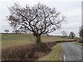
Winter tree on Castleford Lane
The lane beyond the tree has been truncated by a new road not yet on the map.
Image: © Christine Johnstone
Taken: 2 Jan 2011
0.14 miles
3

The edge of Ackton Pasture Wood
Seen across pastureland from Castleford Lane.
Image: © Christine Johnstone
Taken: 2 Jan 2011
0.15 miles
4

Winter tree
Off Castleford Lane, with Ackton Pasture Wood behind.
Image: © Christine Johnstone
Taken: 2 Jan 2011
0.19 miles
5

View across the new roundabout
On the opposite side, Cutsyke Road drops down from Low Laithe Farm.
Image: © Christine Johnstone
Taken: 2 Jan 2011
0.19 miles
6

B6421 Cutsyke Road
Looking south along the B6421 towards North Featherstone. The bridge in the distance is the M62.
Image: © Darren Haddock
Taken: 25 Aug 2006
0.19 miles
7

New road brings new roundabout
Three roads now meet on the south side of the M62 embankment, not two.
Image: © Christine Johnstone
Taken: 2 Jan 2011
0.20 miles
8

Urban street furniture on Cutsyke Road
The new road has brought pavements, dropped kerbs, refuges and bollards to what was previously [despite the nearby M62] a rural lane.
Image: © Christine Johnstone
Taken: 2 Jan 2011
0.21 miles
9

Steps down the M62 embankment
Presumably to provide access to the small grey box.
Image: © Christine Johnstone
Taken: 2 Jan 2011
0.21 miles
