
IMAGES TAKEN NEAR TO
Express Way, Wakefield Europort, NORMANTON, WF6 2TZ
Introduction
This page details the photographs taken nearby to Express Way, Wakefield Europort, WF6 2TZ by members of the Geograph project.
The Geograph project started in 2005 with the aim of publishing, organising and preserving representative images for every square kilometre of Great Britain, Ireland and the Isle of Man.

There are currently over 7.5m images from over14,400 individuals and you can help contribute to the project by visiting https://www.geograph.org.uk
Image Map
Images are licensed for reuse under creativecommons.org/licenses/by-sa/2.0
Notes
- Clicking on the map will re-center to the selected point.
- The higher the marker number, the further away the image location is from the centre of the postcode.
Image Listing (69 Images Found)
Images are licensed for reuse under creativecommons.org/licenses/by-sa/2.0
Image
Details
Distance
1

Filled-in lock at Fairies Hill canal/marina, Whitwood, Castleford
Although not shown on Ordnance Survey maps the canal is cut in two by having the middle lock on its section filled in. Water from the left-hand end, being at a higher level, overflows via a culvert to the right-hand branch.
Image: © derek dye
Taken: 1 Jan 2013
0.08 miles
2

The former Altofts Lock
The lock was filled in when this section of the canal was no longer required following the closure of the adjacent colliery. There are now long term moorings on both sides of the former lock Image & Image
Image: © Graham Hogg
Taken: 11 Apr 2016
0.09 miles
3
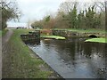
Altofts Lock, Aire & Calder Navigation
With Fairies Hill Lock and Foxholes Lock, Altofts Lock opened in 1833 as part of the scheme to bypass part of the navigation along the River Calder. Along with Fairies Hill Lock, it was itself bypassed by Woodnook Lock in 1842, but remained in use. Altofts Lock was filled in around 1990, after an arson attack damaged the gates and wooden bridge. [With thanks to CRT for the recent history]
Image: © Christine Johnstone
Taken: 19 Dec 2020
0.09 miles
4

Roman levels
The Roman numerals that used to show the depth of the now redundant lock.
Image: © derek dye
Taken: 9 Mar 2018
0.09 miles
5

Canal below a former lock
The lock on the Aire and Calder Navigation has been filled in, with passage via the River Calder.
Image: © DS Pugh
Taken: 25 Feb 2023
0.09 miles
6

Below the blocked off section
Excess water from the main body of the canal overflows past the blocked off section of the old lock and re -emerges through the culvert shown towards the middle of the photo on the far bank.
Image: © derek dye
Taken: 9 Mar 2018
0.09 miles
7

Fairies Hill Cut
The disused Fairies Hill Cut which terminates at Fairies Hill lock, (now a private marina), linking it to the River Calder.
The railway viaduct can just be made out through the mist.
Image: © Mike Kirby
Taken: 19 Nov 2011
0.09 miles

9

Former lock
This lock on the Aire and Calder Navigation has been filled in. A route around this section is possible using the River Calder.
Image: © DS Pugh
Taken: 25 Feb 2023
0.09 miles
10

Blocked lock
Where the canal is blocked off from the canal at Altofts cut. The iron framework can still be seen that used to be fastened to the lock gates.
Image: © derek dye
Taken: 9 Mar 2018
0.09 miles