IMAGES TAKEN NEAR TO
Parker Avenue, NORMANTON, WF6 2NS
Introduction
This page details the photographs taken nearby to Parker Avenue, WF6 2NS by members of the Geograph project.
The Geograph project started in 2005 with the aim of publishing, organising and preserving representative images for every square kilometre of Great Britain, Ireland and the Isle of Man.

There are currently over 7.5m images from over14,400 individuals and you can help contribute to the project by visiting https://www.geograph.org.uk
Image Map
Images are licensed for reuse under creativecommons.org/licenses/by-sa/2.0
Notes
- Clicking on the map will re-center to the selected point.
- The higher the marker number, the further away the image location is from the centre of the postcode.
Image Listing (66 Images Found)
Images are licensed for reuse under creativecommons.org/licenses/by-sa/2.0
Image
Details
Distance
2
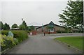
Martin Frobisher Infants' School - Church Road, Altofts
Image: © Betty Longbottom
Taken: 21 Jun 2008
0.03 miles
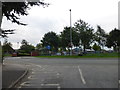
7
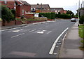
Altofts main road
Photo looking SW from near the church.
Image: © Andy Beecroft
Taken: 27 Aug 2005
0.09 miles