
IMAGES TAKEN NEAR TO
Boundary Lane, NORMANTON, WF6 2JA
Introduction
This page details the photographs taken nearby to Boundary Lane, WF6 2JA by members of the Geograph project.
The Geograph project started in 2005 with the aim of publishing, organising and preserving representative images for every square kilometre of Great Britain, Ireland and the Isle of Man.

There are currently over 7.5m images from over14,400 individuals and you can help contribute to the project by visiting https://www.geograph.org.uk
Image Map
Images are licensed for reuse under creativecommons.org/licenses/by-sa/2.0
Notes
- Clicking on the map will re-center to the selected point.
- The higher the marker number, the further away the image location is from the centre of the postcode.
Image Listing (54 Images Found)
Images are licensed for reuse under creativecommons.org/licenses/by-sa/2.0
Image
Details
Distance
1

Concrete arch bridge over the River Calder
Image: © Steve Fareham
Taken: 18 May 2015
0.07 miles
2

Welbeck land-fill
Viewed from the Pimple, Welbeck land-fill site is in the process of being landscaped.
Image: © Mike Kirby
Taken: 20 May 2009
0.07 miles
3
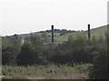
Landfill gas control and utilisation facility
Instead of flaring the gas produced at the Welbeck reclamation site, it is now collected and used to generate up to 8MW of ‘green’ electricity, which is fed into the national grid.
Image: © Mike Kirby
Taken: 15 Oct 2011
0.07 miles
4

Bridge over The River Calder near Newland Hall
The traffic on this bridge is almost exclusively concerned with waste disposal.
Image: © Neil Theasby
Taken: 18 Mar 2022
0.10 miles
5

Riverside path, Newland
On the east bank of the River Calder. In the 1950s and 1960s this would have been in the middle of a railway junction - mineral lines serving St John's Colliery.
Image: © Christine Johnstone
Taken: 24 Mar 2021
0.10 miles
6
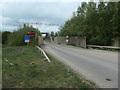
Traffic control at Welbeck's bridge over the Calder
The bridge originally carried a mineral line from St John's colliery. It now provides vehicle access to the Welbeck landfill site on the west bank of the River Calder. Welbeck is the primary waste disposal facility for West Yorkshire and accepts non-hazardous municipal and commercial waste from Wakefield, Kirklees, Leeds, Bradford, Calderdale and Barnsley. About 600,000 tonnes of waste comes here every year, all by road.
Image: © Christine Johnstone
Taken: 28 Apr 2020
0.11 miles
7

Path down towards the River Calder
Not a public footpath, but well-used. The path at the bottom is a public footpath.
Image: © Christine Johnstone
Taken: 28 Apr 2020
0.13 miles
8

Newland Estate - Farm buildings (5)
Massive brick buttresses added at some time to support the original stone walls.
See Image
Image: © Mike Kirby
Taken: 31 Jul 2010
0.15 miles

10
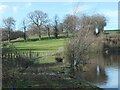
Trees along a field boundary near Newland Hall
At the western end of Newland's largest lake [a former clay pit].
Image: © Christine Johnstone
Taken: 24 Mar 2021
0.15 miles