IMAGES TAKEN NEAR TO
Cardinal Grove, NORMANTON, WF6 2FY

Introduction

This page details the photographs taken nearby to Cardinal Grove, WF6 2FY by members of the Geograph project.

The Geograph project started in 2005 with the aim of publishing, organising and preserving representative images for every square kilometre of Great Britain, Ireland and the Isle of Man.

There are currently over 7.5m images from over14,400 individuals and you can help contribute to the project by visiting https://www.geograph.org.uk

Image Map


Images are licensed for reuse under creativecommons.org/licenses/by-sa/2.0
Notes
  • Clicking on the map will re-center to the selected point.
  • The higher the marker number, the further away the image location is from the centre of the postcode.

Image Listing (8 Images Found)

Images are licensed for reuse under creativecommons.org/licenses/by-sa/2.0
Image
Details
Distance
1
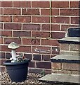
Altofts, Pope Street
The benchmark is cut into the north facing wall of 2 Pope Street, and is to the left of the steps to the front door.
Image: © Mel Towler Taken: 17 Jun 2022
0.03 miles
2
Altofts, Pope Street
There is a benchmark cut into the north facing wall of 2 Pope Street, and is to the left of the steps to the front door.
Image: © Mel Towler Taken: 17 Jun 2022
0.03 miles
3
Site of Altofts & Whitwood station
View eastwards under the ex-Midland Leeds (left) - Sheffield (right) former main line via Normanton, demoted by 1968 to the local 'Hallam Line'. The station (plain 'Altofts' from 4/5/70) had been up on the left and was recently closed, from 12/5/90.
Image: © Ben Brooksbank Taken: 28 Apr 1995
0.06 miles
4
Railway bridge over Pope Street
Image: © JThomas Taken: 17 Dec 2011
0.10 miles
5
Pope Street Railway Bridge
Image: © Glyn Drury Taken: 6 Jul 2009
0.10 miles
6
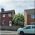
Pope Street heading east
Image: © JThomas Taken: 17 Dec 2011
0.12 miles
7
Do they dance at night?
Image: © Christine Johnstone Taken: 11 Nov 2009
0.14 miles
8
Wakefield Europort
A European rail freight terminal, close to warehouses and motorways.
Image: © Christine Johnstone Taken: 11 Nov 2009
0.25 miles