IMAGES TAKEN NEAR TO
Cypress Road, NORMANTON, WF6 1LJ
Introduction
This page details the photographs taken nearby to Cypress Road, WF6 1LJ by members of the Geograph project.
The Geograph project started in 2005 with the aim of publishing, organising and preserving representative images for every square kilometre of Great Britain, Ireland and the Isle of Man.

There are currently over 7.5m images from over14,400 individuals and you can help contribute to the project by visiting https://www.geograph.org.uk
Image Map (Loading...)


Getting Data...Please wait
Leaflet Map data © OpenStreetMap
Images are licensed for reuse under creativecommons.org/licenses/by-sa/2.0
Notes
- Clicking on the map will re-center to the selected point.
- The higher the marker number, the further away the image location is from the centre of the postcode.
Image Listing (36 Images Found)
Images are licensed for reuse under creativecommons.org/licenses/by-sa/2.0
Image
Details
Distance
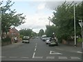
1

Dodsworth Crescent - Queen Elizabeth Drive
Image: © Betty Longbottom
Taken: 25 Jul 2009
0.01 miles
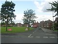
2

Woodhouse Community Centre - Queen Elizabeth Drive
This was formerly a church (denomination unknown).
Image: © Betty Longbottom
Taken: 25 Jul 2009
0.04 miles
3

Woodhouse Community Centre
Also known as The Grace Christian Centre, used as a place of worship on Sundays.
Image: © Bill Henderson
Taken: 18 Jun 2013
0.06 miles

5

Cedar Road - Queen Elizabeth Drive
Image: © Betty Longbottom
Taken: 25 Jul 2009
0.09 miles

7
Henderson Avenue - Queen Elizabeth Drive
Image: © Betty Longbottom
Taken: 25 Jul 2009
0.13 miles

9
Woodhouse Crescent - Queen Elizabeth Drive
Image: © Betty Longbottom
Taken: 25 Jul 2009
0.17 miles
10

Cypress Road - viewed from Dalefield Road
Image: © Betty Longbottom
Taken: 25 Jul 2009
0.17 miles