
IMAGES TAKEN NEAR TO
Manor Road, WAKEFIELD, WF4 6HH
Introduction
This page details the photographs taken nearby to Manor Road, WF4 6HH by members of the Geograph project.
The Geograph project started in 2005 with the aim of publishing, organising and preserving representative images for every square kilometre of Great Britain, Ireland and the Isle of Man.

There are currently over 7.5m images from over14,400 individuals and you can help contribute to the project by visiting https://www.geograph.org.uk
Image Map
Images are licensed for reuse under creativecommons.org/licenses/by-sa/2.0
Notes
- Clicking on the map will re-center to the selected point.
- The higher the marker number, the further away the image location is from the centre of the postcode.
Image Listing (310 Images Found)
Images are licensed for reuse under creativecommons.org/licenses/by-sa/2.0
Image
Details
Distance
1

Ziggis Hair Salon - Tithe Barn Street
Image: © Betty Longbottom
Taken: 15 Feb 2010
0.02 miles
2

Access road off Tithe Barn Street, Horbury
The private road gives access to a large property known as Pontefract House (named on older maps as Warden Lodge). I thought that the brick buildings to the left here might be the grade II listed wartime gas decontamination centre, but on reading the description it seems that is a flat roofed building on Manor Road
Image: © Stephen Craven
Taken: 22 Apr 2019
0.02 miles

4

Horbury gas decontamination centre
When I photographed this from the far end of the car park Image I didn't realise its significance, or I would have taken a closer look. This plain single storey brick building of 1939 would have been used as a civilian Decontamination Centre in the event of a German gas attack, and has been listed grade II (list entry 1462139) as a well preserved example.
Image: © Stephen Craven
Taken: 22 Apr 2019
0.03 miles
5

Pins & Needles - Tithe Barn Street
Image: © Betty Longbottom
Taken: 15 Feb 2010
0.03 miles

7
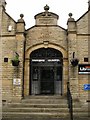
Knowledge is Power
The entrance to Horbury Library (1905) built with money from the Carnegie Foundation.
Image: © SMJ
Taken: 30 Jun 2008
0.03 miles

9

Lee & Briggs cover, Horbury
A stop tap cover or similar, bearing the name of a local manufacturer. In a pavement on the south site of Tithe Barn Street outside a closed church Image
Image: © Stephen Craven
Taken: 22 Apr 2019
0.04 miles
10

Carnegie Free Library - High Street
Image: © Betty Longbottom
Taken: 2 Feb 2008
0.04 miles