
IMAGES TAKEN NEAR TO
Dovecote Lane, WAKEFIELD, WF4 6BB
Introduction
This page details the photographs taken nearby to Dovecote Lane, WF4 6BB by members of the Geograph project.
The Geograph project started in 2005 with the aim of publishing, organising and preserving representative images for every square kilometre of Great Britain, Ireland and the Isle of Man.

There are currently over 7.5m images from over14,400 individuals and you can help contribute to the project by visiting https://www.geograph.org.uk
Image Map
Images are licensed for reuse under creativecommons.org/licenses/by-sa/2.0
Notes
- Clicking on the map will re-center to the selected point.
- The higher the marker number, the further away the image location is from the centre of the postcode.
Image Listing (258 Images Found)
Images are licensed for reuse under creativecommons.org/licenses/by-sa/2.0
Image
Details
Distance
1

Horbury Convent
This grade II Listed building is now occupied by St Hilda's School. Photograph taken from footpath by the cemetery.
Image: © SMJ
Taken: 16 Jun 2008
0.03 miles
2

St Hilda's School
St Hilda's School is housed in a Listed Grade II Convent
Image: © SMJ
Taken: 20 Jun 2008
0.03 miles
3

Over the wall
A view of Horbury Convent from the ginnel
Image: © SMJ
Taken: 20 Jun 2008
0.04 miles
4

Horbury - Silcoates St Hildas School
For an alternative view, please see Image
Image: © Dave Bevis
Taken: 14 Jul 2012
0.04 miles

7
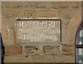
Plaque on former Methodist Chapel, Horbury
The Methodists used this alternative spelling for 'connection'.
Image: © Humphrey Bolton
Taken: 4 Mar 2010
0.05 miles
8
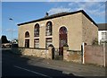
Former Methodist Chapel, Northgate, Horbury
This was a 'New Connexion' Chapel dated 1824. This was the first group to break away from the main Methodist body, in 1797. They were led by Alexander Kilham, but not for long as he died in 1798. It looks like a house, but is captioned 'Mission Room' on the large-scale OS map. For date stone see Image
Image: © Humphrey Bolton
Taken: 4 Mar 2010
0.05 miles

10

Gervase Road - viewed from Manor Road
Image: © Betty Longbottom
Taken: 7 Apr 2015
0.06 miles