IMAGES TAKEN NEAR TO
Ranters Fold, WAKEFIELD, WF4 6AU
Introduction
This page details the photographs taken nearby to Ranters Fold, WF4 6AU by members of the Geograph project.
The Geograph project started in 2005 with the aim of publishing, organising and preserving representative images for every square kilometre of Great Britain, Ireland and the Isle of Man.

There are currently over 7.5m images from over14,400 individuals and you can help contribute to the project by visiting https://www.geograph.org.uk
Image Map
Images are licensed for reuse under creativecommons.org/licenses/by-sa/2.0
Notes
- Clicking on the map will re-center to the selected point.
- The higher the marker number, the further away the image location is from the centre of the postcode.
Image Listing (337 Images Found)
Images are licensed for reuse under creativecommons.org/licenses/by-sa/2.0
Image
Details
Distance
1

Tithe Barn St.
Some of the oldest buildings in Horbury.
Image: © SMJ
Taken: 13 Aug 2008
0.02 miles
3

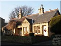
Kidcote - Tithe Barn Street
Built c1710 as the Parish lock-up.
Image: © Betty Longbottom
Taken: 5 Feb 2008
0.02 miles
4
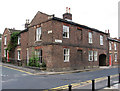
Horbury - house at junction of Tithe Barn Street and Northgate
Image: © Dave Bevis
Taken: 14 Jul 2012
0.03 miles
5

The old parish lock-up in Horbury
As the blue sign informs passers-by, it was built around 1710 when it was referred to as "The Kidcote".
Image: © Neil Theasby
Taken: 27 Aug 2015
0.03 miles
6

The old lock-up, Horbury
The small 19th century building on Tithe Barn Street was used to lock up petty offenders. Listed grade II (list entry 1135517). See Image for a close-up of the door.
Image: © Stephen Craven
Taken: 22 Apr 2019
0.03 miles
7

St Leonard's Hospital, Horbury
Former parish almshouses built in 1888 to replace an earlier building of 1731, used after 1960 as a youth centre and now the Parish Room.
Image: © Stephen Craven
Taken: 22 Apr 2019
0.03 miles
8

The old town school, Horbury
The building on the left was the town's school from 1708 to 1886. Listed grade II (list entry 1183992). See Image for the plaque.
Image: © Stephen Craven
Taken: 22 Apr 2019
0.03 miles
9
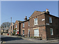
The east end of Tithe Barn Street, Horbury
The building on the corner is 47-51 Tithe Barn Street, an 18th century building, listed grade II (list entry 1184022), see also Image
Image: © Stephen Craven
Taken: 22 Apr 2019
0.03 miles