IMAGES TAKEN NEAR TO
Park View, WAKEFIELD, WF4 4AF
Introduction
This page details the photographs taken nearby to Park View, WF4 4AF by members of the Geograph project.
The Geograph project started in 2005 with the aim of publishing, organising and preserving representative images for every square kilometre of Great Britain, Ireland and the Isle of Man.

There are currently over 7.5m images from over14,400 individuals and you can help contribute to the project by visiting https://www.geograph.org.uk
Image Map
Images are licensed for reuse under creativecommons.org/licenses/by-sa/2.0
Notes
- Clicking on the map will re-center to the selected point.
- The higher the marker number, the further away the image location is from the centre of the postcode.
Image Listing (33 Images Found)
Images are licensed for reuse under creativecommons.org/licenses/by-sa/2.0
Image
Details
Distance
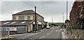
3
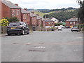
Park Side - looking towards Barnsley Road
Image: © Betty Longbottom
Taken: 12 Jul 2016
0.07 miles
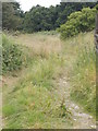
4
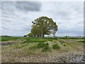
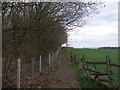
Trees defining the field boundary
To the left in this view is The Rough
Image: © Kevin Waterhouse
Taken: 5 May 2024
0.08 miles
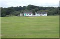
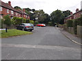
6
Across the fields towards Flockton Cricket Pitch
Image: © Nigel Homer
Taken: 14 Jan 2006
0.09 miles
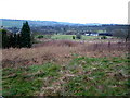
7
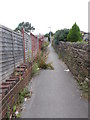
Footpath alongside woodland at The Rough
Image: © John Slater
Taken: 16 Apr 2012
0.12 miles