
IMAGES TAKEN NEAR TO
St. Johns Gardens, WAKEFIELD, WF4 3NF
Introduction
This page details the photographs taken nearby to St. Johns Gardens, WF4 3NF by members of the Geograph project.
The Geograph project started in 2005 with the aim of publishing, organising and preserving representative images for every square kilometre of Great Britain, Ireland and the Isle of Man.

There are currently over 7.5m images from over14,400 individuals and you can help contribute to the project by visiting https://www.geograph.org.uk
Image Map
Images are licensed for reuse under creativecommons.org/licenses/by-sa/2.0
Notes
- Clicking on the map will re-center to the selected point.
- The higher the marker number, the further away the image location is from the centre of the postcode.
Image Listing (82 Images Found)
Images are licensed for reuse under creativecommons.org/licenses/by-sa/2.0
Image
Details
Distance
1

St John's Gardens, Calder Grove
This development of four detached houses, of which two are seen here, takes its name from the adjacent St John's church; in fact part of the churchyard was sold to the developer to build them. The right hand house in this view and the drive in front are roughly on the site of the former church hall Image
Image: © Stephen Craven
Taken: 25 Apr 2016
0.01 miles
2
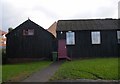
Church Hall
This corrugated building is on Primrose Lane next to the church.
Image: © SMJ
Taken: 8 Nov 2008
0.01 miles
3

St John the Evangelist, Calder Grove: west end
The church was built as a consecrated chapel of ease to the parish of Chapelthorpe in 1892-3 in memory of local industrialist John Mackie. Architect William Swinden Barber. The building was listed grade 2 in 2016 (list entry number 1431631) and the listing gives much more detail. There is a single bell in the bellcote at this end
Image: © Stephen Craven
Taken: 25 Apr 2016
0.01 miles
4

St John the Evangelist, Calder Grove
The church was built as a consecrated chapel of ease to the parish of Chapelthorpe in 1892-3 in memory of local industrialist John Mackie. Architect William Swinden Barber. The building was listed grade 2 in 2016 (list entry number 1431631) and the listing gives much more detail.
Image: © Stephen Craven
Taken: 25 Apr 2016
0.01 miles
5

St John the Evangelist, Calder Grove: east end
The church was built as a consecrated chapel of ease to the parish of Chapelthorpe in 1892-3 in memory of local industrialist John Mackie. Architect William Swinden Barber. The building was listed grade 2 in 2016 (list entry number 1431631) and the listing gives much more detail.
Image: © Stephen Craven
Taken: 25 Apr 2016
0.01 miles
6

Primrose Lane - Denby Dale Road West
Image: © Betty Longbottom
Taken: 12 Jan 2016
0.02 miles
7
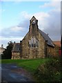
St John, Calder Grove
Photograph taken from Primrose Lane.
Image: © SMJ
Taken: 8 Nov 2008
0.02 miles

9

Denby Dale Road West, junction with new road
The road running left-right in the foreground would originally have been just Denby Dale Road. But since it got cut off by the M1, that name passed to the new alignment of the A636 to the north (seen with a couple of cars). This view is looking north from outside St John's church.
Image: © Stephen Craven
Taken: 25 Apr 2016
0.04 miles
10

Denby Dale Road West, looking west
The road would originally have been just Denby Dale Road. But since it got cut off by the M1, that name passed to the new alignment of the A636 to the north. This view is looking west from the junction with Primrose Lane.
Image: © Stephen Craven
Taken: 25 Apr 2016
0.04 miles