
IMAGES TAKEN NEAR TO
Church Lane, WAKEFIELD, WF4 3JB
Introduction
This page details the photographs taken nearby to Church Lane, WF4 3JB by members of the Geograph project.
The Geograph project started in 2005 with the aim of publishing, organising and preserving representative images for every square kilometre of Great Britain, Ireland and the Isle of Man.

There are currently over 7.5m images from over14,400 individuals and you can help contribute to the project by visiting https://www.geograph.org.uk
Image Map
Images are licensed for reuse under creativecommons.org/licenses/by-sa/2.0
Notes
- Clicking on the map will re-center to the selected point.
- The higher the marker number, the further away the image location is from the centre of the postcode.
Image Listing (49 Images Found)
Images are licensed for reuse under creativecommons.org/licenses/by-sa/2.0
Image
Details
Distance
1
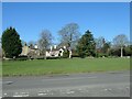
Houses on Church Lane, Chapelthorpe
The grey house was built before 1890. The white one is more recent.
Image: © Christine Johnstone
Taken: 8 Apr 2022
0.02 miles
2
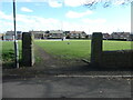
Old redundant gateposts, Chapelthorpe
At the junction of Hall Lane and Church Lane. The large grassy area between the gateposts and Fairbrook Road is neither fenced nor gated.
Image: © Christine Johnstone
Taken: 8 Apr 2022
0.03 miles
3

Hall Lane, Chapelthorpe
Seen from the junction with Church Lane.
Image: © Humphrey Bolton
Taken: 6 Jan 2011
0.03 miles
4
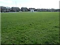
Bus stop, Fairbrook Road, Chapelthorpe
Fairbrook Road was only created when Wakefield Council built the housing estate in the 1950s.
Image: © Christine Johnstone
Taken: 8 Apr 2022
0.05 miles
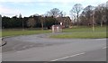

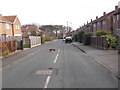
8
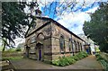
St James' church, Chapelthorpe
West and south sides, for full description see: https://www.geograph.org.uk/photo/7763350
Image: © Chris Morgan
Taken: 26 Apr 2024
0.08 miles
9
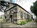
Church of St James
A grade II listed church dating from 1771, destroyed by fire in 1951 and rebuilt in facsimile.
Image: © Graham Hogg
Taken: 26 Apr 2024
0.08 miles
10

Hall Lane, Chapelthorpe
In the 1800s this was the main road through the village of Chapelthorpe. What is now Church Lane [where it is parallel to Hall Lane] was then Back Lane.
Image: © Christine Johnstone
Taken: 8 Apr 2022
0.08 miles