
IMAGES TAKEN NEAR TO
Painthorpe Lane, WAKEFIELD, WF4 3HE
Introduction
This page details the photographs taken nearby to Painthorpe Lane, WF4 3HE by members of the Geograph project.
The Geograph project started in 2005 with the aim of publishing, organising and preserving representative images for every square kilometre of Great Britain, Ireland and the Isle of Man.

There are currently over 7.5m images from over14,400 individuals and you can help contribute to the project by visiting https://www.geograph.org.uk
Image Map
Images are licensed for reuse under creativecommons.org/licenses/by-sa/2.0
Notes
- Clicking on the map will re-center to the selected point.
- The higher the marker number, the further away the image location is from the centre of the postcode.
Image Listing (35 Images Found)
Images are licensed for reuse under creativecommons.org/licenses/by-sa/2.0
Image
Details
Distance
4
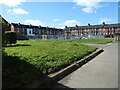
Play area, Painthorpe
On the site of a demolished school, between Painthorpe Lane and Daw Green Avenue.
Image: © Christine Johnstone
Taken: 8 Apr 2022
0.08 miles
8
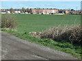
Painthorpe Terrace from Hollingthorpe Lane
The three-storey houses were built between 1891 and 1904 to house miners and their families.
Image: © Christine Johnstone
Taken: 8 Apr 2022
0.09 miles
9
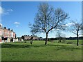
Public open space, Painthorpe
A mineral line to Crigglestone colliery once ran across this area and on through the gap between the two rows of terraced houses.
Image: © Christine Johnstone
Taken: 8 Apr 2022
0.10 miles
10
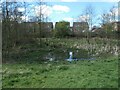
Small pond, Betty Eastwood Park, Crigglestone
The park is designated open access land. It is named after Betty Eastwood [1913-1990] who was a 'resolute and charismatic' local teacher who was active in many organisations in Crigglestone and beyond.
Image: © Christine Johnstone
Taken: 8 Apr 2022
0.11 miles